News
Northern California Braces for Cooler Weather Ahead of Rain and Snow
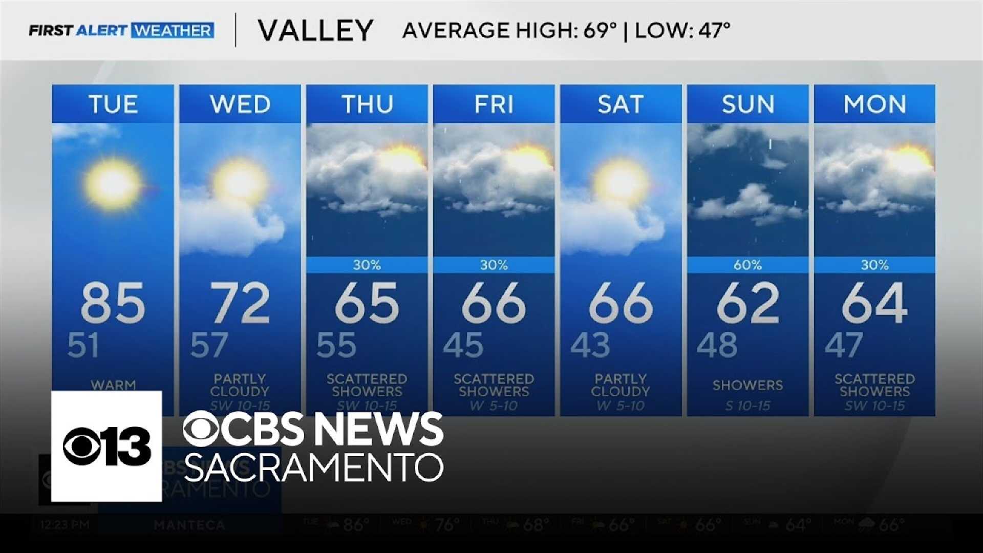
SACRAMENTO, Calif. — A significant weather shift is on the horizon for Northern California, as milder temperatures are expected on Wednesday following record warmth earlier in the week. Meteorologists predict that many areas will see temperatures drop from nearly 90 degrees to around 73 degrees in downtown Sacramento.
According to meteorologist Tamara Berg, Tuesday’s unusually high temperatures will give way to cooler conditions, marked by an onshore breeze and scattered clouds. “It’s going to feel noticeably different with afternoon wind gusts in the Sacramento Valley possibly exceeding 20 mph, bringing a refreshing change to the atmosphere,” she said.
After a warm Tuesday, Wednesday’s forecast is in stark contrast, with highs around 73 degrees, slightly above the seasonal average of 69 degrees. In the foothills, the weather remains humid with a chance of drizzle and light rain throughout the day. Thunderstorms are not anticipated but could emerge later in the week.
Thursday will mark the arrival of light rain and mountain snow as a system moves across the region, according to meteorologist Heather Waldman. “Most areas will experience dry spells, but there will be showers, particularly in the Foothills, while Sierra travelers should prepare for high-elevation snow,” she noted.
The KCRA 3 weather team is announcing an Impact Day for Friday, warning commuters of potential travel disruptions due to expected snow in the Sierra. Chain controls are likely, with speed limits on Interstate 80 and Highway 50 decreasing to 30 and 25 mph, respectively, when the chains are issued.
Friday will see damp conditions and scattered showers in the Valley, while the Sierra could experience measurable snow accumulation as the snow level drops to around 5,000 feet. “Expect challenging travel conditions over the summits on Friday evening as wind and snow will make driving difficult,” Waldman cautioned.
The forecast further indicates a dry weekend but warns of a return to wetter conditions by Sunday. Rain is predicted in the Valley alongside possible chain controls for elevations reaching above 5,500 feet. The weather team is closely monitoring another potential atmospheric river event slated for next Wednesday, marking it as another Impact Day.
As meteorologists keep a close watch on the changing conditions, residents are encouraged to prepare for the fluctuating temperatures and possible travel impacts this week.


