News
Northern California Faces Below Average Temperatures and Rain this Week
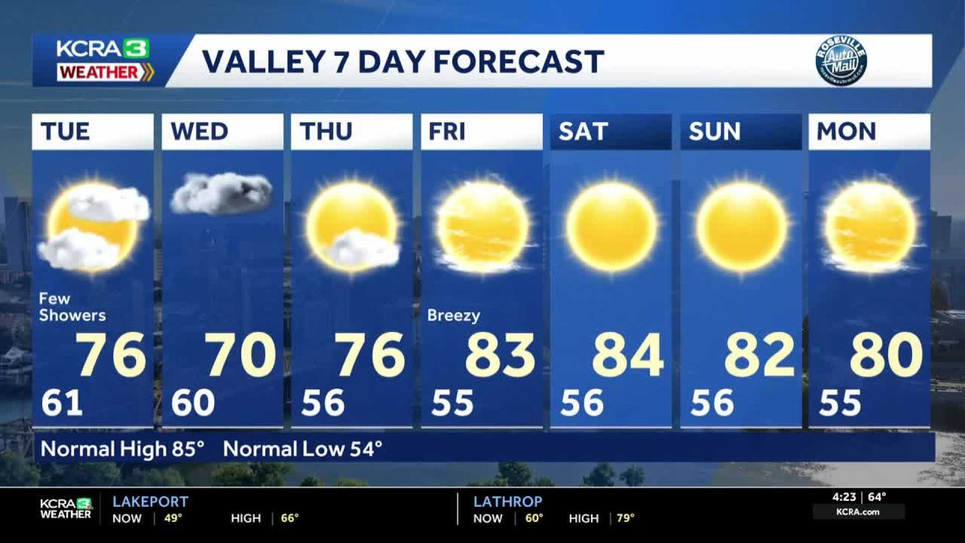
SACRAMENTO, Calif. — Northern California will experience below-average temperatures and rain as a series of storms moves through the region early this week. Meteorologist Tamara Berg said temperatures will be more than 10 degrees lower than the seasonal average.
The week’s forecast indicates that downtown Sacramento may reach a high of 74 degrees Monday, down from Sunday’s high of 73 degrees. The average for this time of year is typically around 85 degrees. In the Foothills, temperatures could peak in the upper 60s, while the Sierra may see highs in the low 60s.
The first signs of this change in weather will emerge on Monday, with increased cloud cover and potential scattered showers and thunderstorms, particularly in higher elevations. Rainfall in the Sacramento Valley is expected to be minimal, with estimates suggesting only 0.05 inches could fall.
Throughout Monday, the weather will remain largely cloudy, with the potential for a few showers in the afternoon. The Coastal Range and northern Sacramento Valley are expected to feel the initial impacts of the storm system, while the foothills may witness isolated thunderstorms.
Rainfall totals for lower elevations will generally be low, with forecasts indicating less than 0.10 inches from Monday to Tuesday. However, drifting thunderstorms from the mountains could lead to heavier bursts of rain, along with occasional lightning and gusty winds.
Berg mentioned that the best chances for more widespread rain will occur on Wednesday, when measurable amounts could fall in the region. Conditions should start to clear by mid-week as high pressure returns, bringing warmer temperatures by the weekend.
Overall, first-time tracking this early in the season can be challenging, with potential adjustments to forecasts expected as the week progresses.


