News
Ocean Exploration Team Claims to Have Found Amelia Earhart’s Plane in Pacific Ocean

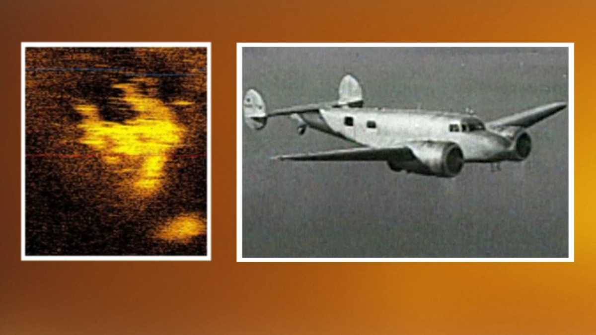
An ocean exploration team believes they’ve found iconic pilot Amelia Earhart’s plane in the heart of the Pacific Ocean. The group, known as Deep Sea Vision, captured sonar images that resemble a plane lodged more than 16,000 feet underwater, equivalent to around 12 Empire State Buildings stacked on top of each other.
The team captured the image around 100 miles off Howland Island, an uninhabited coral atoll in the central Pacific Ocean where Earhart was supposed to refuel during her second and final attempt to fly around the world at the equator in 1937. During this expedition, Earhart flew a Lockheed Electra 10E, a twin-engined plane about the size of a school bus. “One of the most unique key characteristics of [Amelia Earhart’s] aircraft were the distinctive twin vertical stabilizers on the tail,” Tony Romeo, former pilot and CEO of Deep Sea Vision, wrote in an email sent to Live Science.
Between September and December 2023, a 16-member crew from Deep Sea Vision surveyed more than 5,300 square feet of the ocean floor using an underwater drone called Hugin. Some experts say the images are credible enough to raise the possibility that this was Earhart’s plane. However, others, including The International Group for Historic Aircraft Recovery (TIGHAR), cast doubt on the idea. TIGHAR representatives said they believe Earhart landed on an island in Kiribati and lived as a castaway before dying.
Romeo offered an explanation for the discrepancy in the images. “It is important to note that sonar data will appear more and more stretched the further the target is from the sonar. For this reason, the wings appear to be stretched or ‘swept’. You’ll notice that the tail section also appears to be ‘swept’ for this same reason,” he said. “If the tail and wings are both ‘straightened’ out, the shape of the target looks very much like [Amelia Earhart’s] Lockheed Electra.”
Sonar has long been used to map the seafloor for navigational purposes or to search for missing objects, like planes and shipwrecks. However, images from the extreme depths where Deep Sea Vision captured the scan can look unclear. The image is “compelling and deserves further attention,” marine scientist from the Scripps Institution of Oceanography, part of the University of California, San Diego, said.
The Deep Sea Vision team plans to go back to the site later this year to investigate further, according to The Wall Street Journal.


