News
Omega Block Pattern Promises Odd Weather Across the U.S.
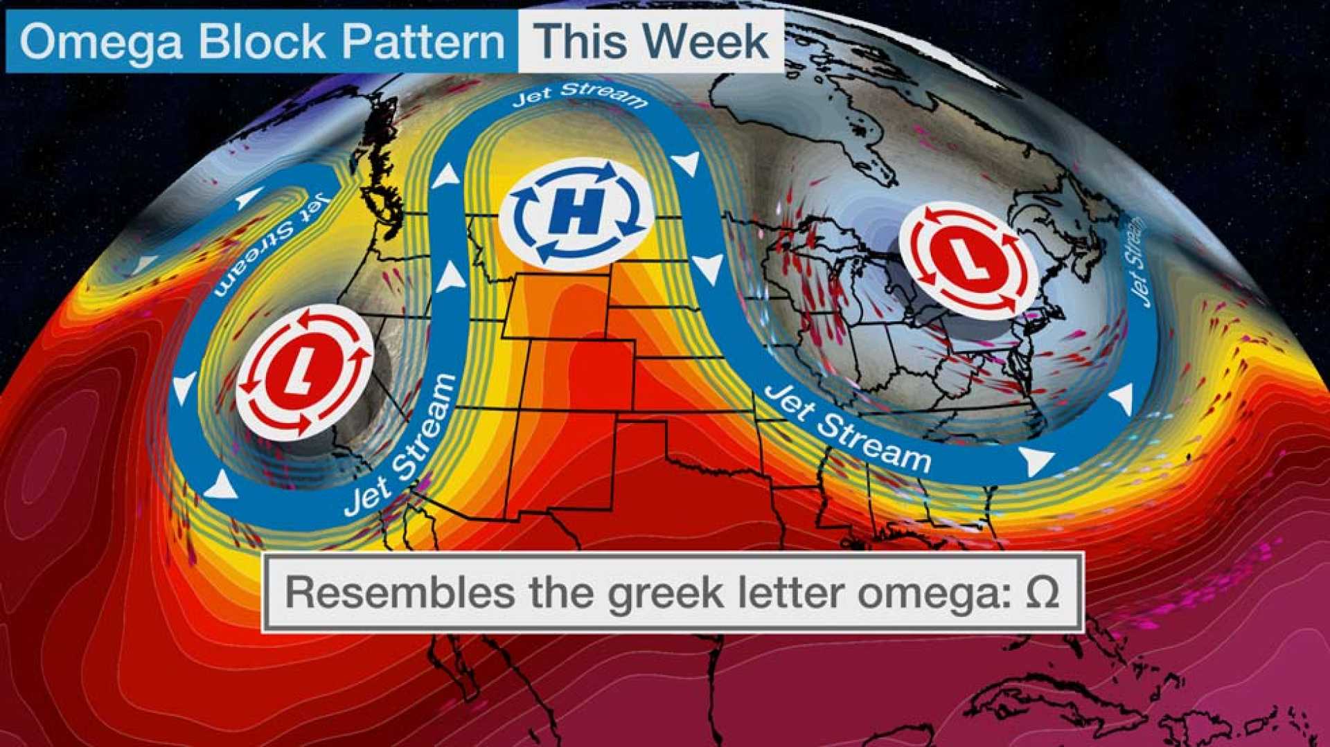
OMAHA, Neb. — A unique weather pattern known as the omega block is set to impact the Plains and Northeast with potential flooding rain during the first full week of May.
The omega block, named for its resemblance to the Greek letter Omega (Ω), is formed when the jet stream takes on a blocking shape across the country. This configuration disrupts the typical west-to-east flow of weather systems, slowing them down significantly.
According to meteorologists, the slow-moving weather systems created by this pattern could lead to several days of unsettled weather, especially across the Plains. Areas on the southern and central Plains are forecasted to experience locally heavy rain from Sunday through at least Wednesday.
However, this rainfall may exacerbate existing river flooding and lead to flash flooding, particularly in Oklahoma and northern Texas, both of which have recently faced heavy rainfall.
In the Northeast, heavy rain is also expected, particularly along the I-95 corridor, which stretches from Washington D.C. to southern New England. Persistent heavy rain bands could pose flash flooding threats in urban and hilly regions.
Conversely, the northern half of the omega block is likely to see drier and sunnier conditions, with warmer-than-average temperatures. For states from Montana to Minnesota, highs could reach the 70s and 80s. Curiously, parts of the Desert Southwest, including Las Vegas, may experience relatively cooler temperatures, not reaching 70 degrees early in the week.
Jonathan Erdman, a senior meteorologist at weather.com, noted the significance of this pattern in delivering unusual weather. “Extreme and bizarre weather are my favorite topics,” he stated.
Overall, this omega block may lead to an intriguing and eventful week of weather across various regions of the United States.


