News
Potential Severe Thunderstorms Hit Carolinas This Weekend
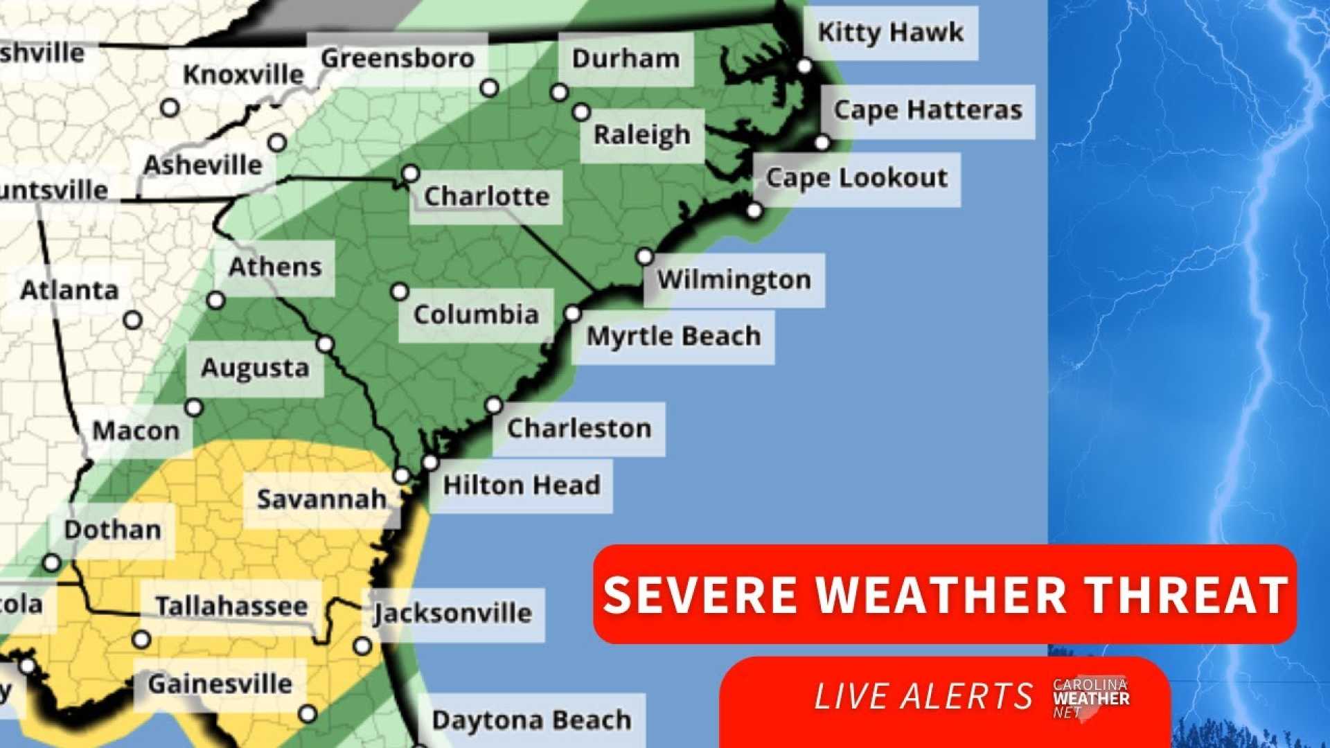
COLUMBIA, S.C. — A cold front is set to bring widespread rainfall and potential severe thunderstorms to Eastern North Carolina and South Carolina this weekend. The storms are expected to begin early Sunday morning, possibly affecting morning churchgoers and those running errands.
From pre-sunrise through midday Sunday, heavy downpours, strong gusty winds, and small hail may accompany the storms. The Storm Prediction Center has placed the region under a level 1 marginal risk for severe storms, indicating that while strong winds and hail are possible, the overall severe threat remains low.
As the system progresses, areas in South Carolina experienced strong storms Saturday evening, with wind gusts reported between 50 and 60 mph. The National Weather Service issued special weather statements for these severe storms, which could continue overnight into early Sunday.
The storms are expected to arrive in various regions at different times, with the Upstate anticipated to experience them after 9:00 PM, and the Lowcountry around 1:00 AM. Meteorologists suggest keeping electronic devices charged and alert for any updates or warnings.
As conditions develop throughout the day, there will be brief lulls in storm activity, allowing for some sunshine occasionally. However, spotty showers and isolated storms could redevelop later in the afternoon. Though the risk of severe storms remains low, authorities urge residents to remain vigilant.
For real-time updates, residents are encouraged to check the WITN Weather App for radar and storm tracking. Communities across North Carolina and Virginia have seen varying rainfall amounts during the week, and some areas may receive another inch or two from this weekend’s weather system.


