News
D.C. Residents Set for Warm Weather and Cherry Blossom Festivities
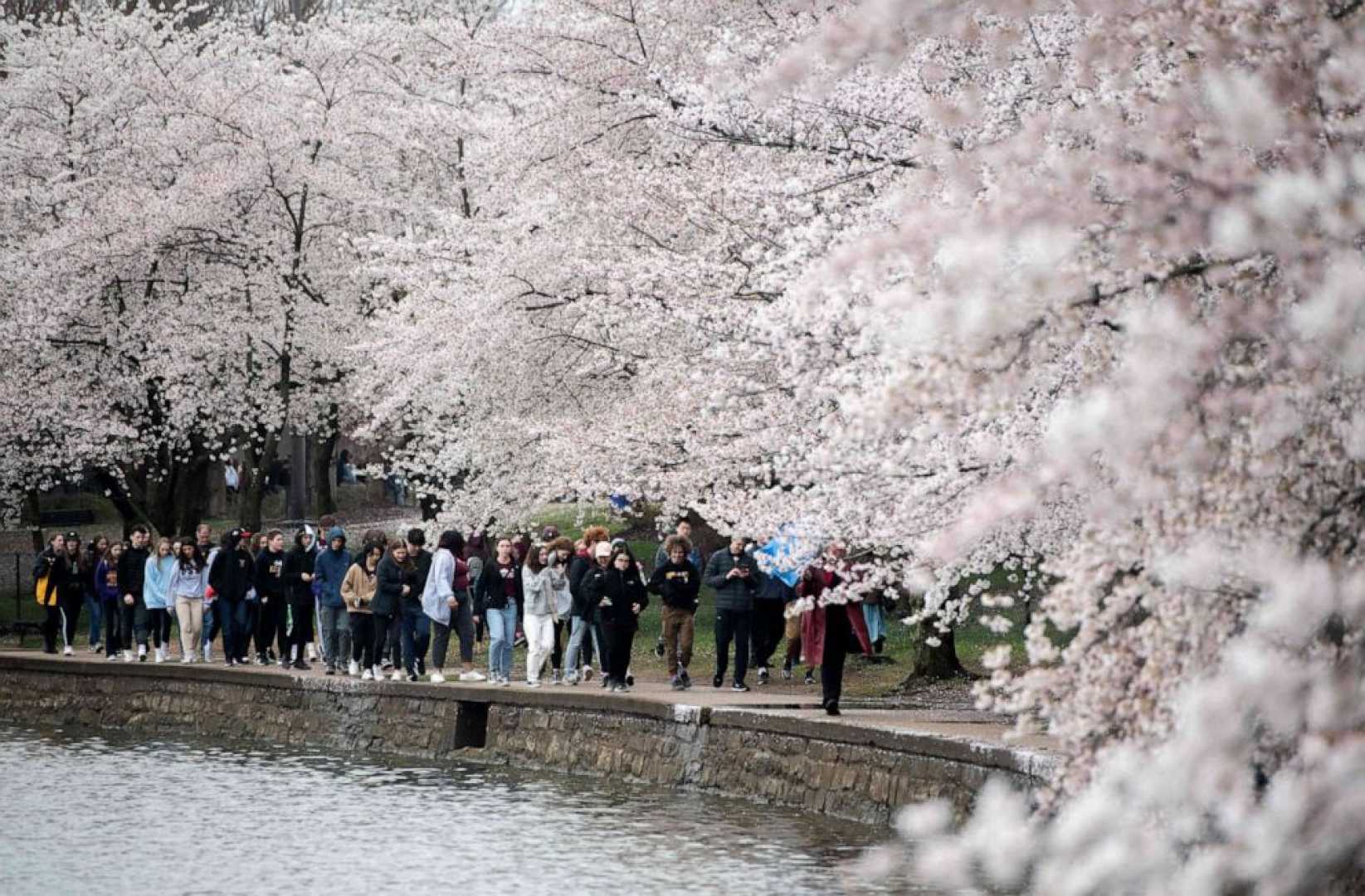
WASHINGTON, D.C. — On Saturday, March 29, 2025, residents in the D.C. area can expect unseasonably warm temperatures reaching the low to mid-80s, creating ideal conditions for viewing the cherry blossoms in full bloom.
Despite overcast skies, this Saturday is projected to be the warmest day of the year so far, prompting many to shed their winter layers. However, the National Weather Service (NWS) has issued warnings concerning increased fire risks in the area, advising against open burning due to potential hazards.
According to 7News First Alert Meteorologist Eileen Whelan, southwesterly winds may carry smoke from localized fires in nearby mountains into the D.C. region, possibly affecting air quality. Whelan noted, “The winds will create the perfect climate for cherry blossom viewing, but also raise sensitivity around smoke in the air.”
The National Mall and Tidal Basin are expected to be congested as visitors flock to view the blossoms, with reported traffic backups along Independence Avenue and 17th Street. Traffic disruptions are also anticipated near the Nationals Park, where the D.C. baseball team will be hosting the Philadelphia Phillies for a 4 p.m. game.
The warm temperatures are projected to continue into Sunday, offering another mild day with highs in the upper 70s. However, rainstorms are likely to arrive on Monday as a cold front approaches the region, necessitating caution for outdoor activities.
The weather forecast for the weekend indicates the following: Saturday evening will remain mostly cloudy, with temperatures in the 70s and light winds at 5-10 mph. Saturday night will see milder conditions with temperatures dropping to the low 60s.
On Sunday, clouds will dominate the sky with the potential for isolated showers and temperatures reaching around 80 degrees. Winds will shift to 5-15 mph, with gusts up to 25 mph expected.
Looking ahead to Monday, a storm alert remains in effect as conditions turn partly to mostly cloudy with high temperatures in the 70s. Strong winds and thunderstorms are likely, signaling a transition into a cooler weather pattern by Tuesday, with highs in the 55-60 degree range.
The weather team will continue to monitor developments and provide updates as the system progresses.


