News
Severe Spring Storm Expected to Hit Central U.S. This Week
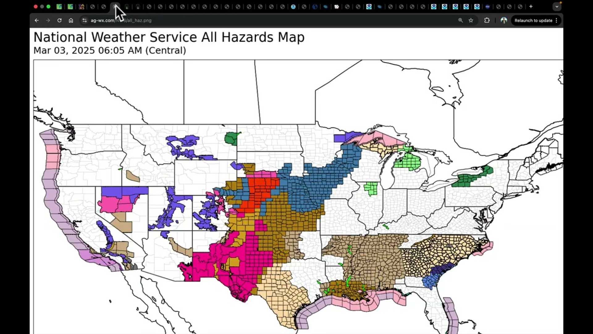
PHOENIX, Ariz. — A spring storm bringing severe weather is projected to impact the United States through the middle of the week, with thunderstorms and critical fire risk conditions affecting various regions. The National Weather Service (NWS) has issued warnings as this multihazard storm moves across the Central Plains and Midwest toward the Great Lakes starting Monday evening.
According to the NWS, “Thunderstorms should increase late this evening and merge into a squall line overnight across parts of the southern and central Plains. Several tornadoes, scattered to numerous severe wind gusts, and large hail are all possible.” Heavy snow and strong winds are expected to create dangerous travel conditions across Nebraska and parts of the Midwest through Tuesday.
The forecast indicates that blowing snow may significantly reduce visibility, with localized whiteout conditions likely. The NWS reported, “A strong cold front will bring severe weather across parts of the South, including Louisiana, Mississippi, and Alabama, extending to eastern states like Virginia from Tuesday into Wednesday.”
Concerns remain for very strong damaging winds and potential tornadoes across the central Gulf Coast. On Wednesday, thunderstorms and heavy rains could lead to damaging winds and possibly a few tornadoes.
Additionally, red flag warnings are in effect for parts of Texas through Tuesday evening, and fire weather watches are in place across Texas, New Mexico, and Oklahoma, indicating an increased risk of fire due to low humidity, warm temperatures, and strong winds. The NWS warns that “these strong winds can make driving difficult,” with advisories forecast for eastern Texas starting Tuesday evening, extending across the South to East Georgia through Wednesday evening.
In the Carolinas, increased fire danger also persists, particularly in upper South Carolina and western North Carolina, which have experienced wildfires driven by high winds, low humidity, and dry conditions. The NWS noted, “Although relative humidity will be higher during the day Tuesday, temperatures will be warmer and winds will be stronger during the afternoon.”
Central North Carolina faces heightened fire danger as well, with expected wind gusts of 20 to 25 mph throughout the region. As of Monday evening, more than 193 fires were reported burning across North Carolina, while over 4,300 acres have been scorched across South Carolina.


