News
Severe Storm Alert Issued for Houston Area Friday
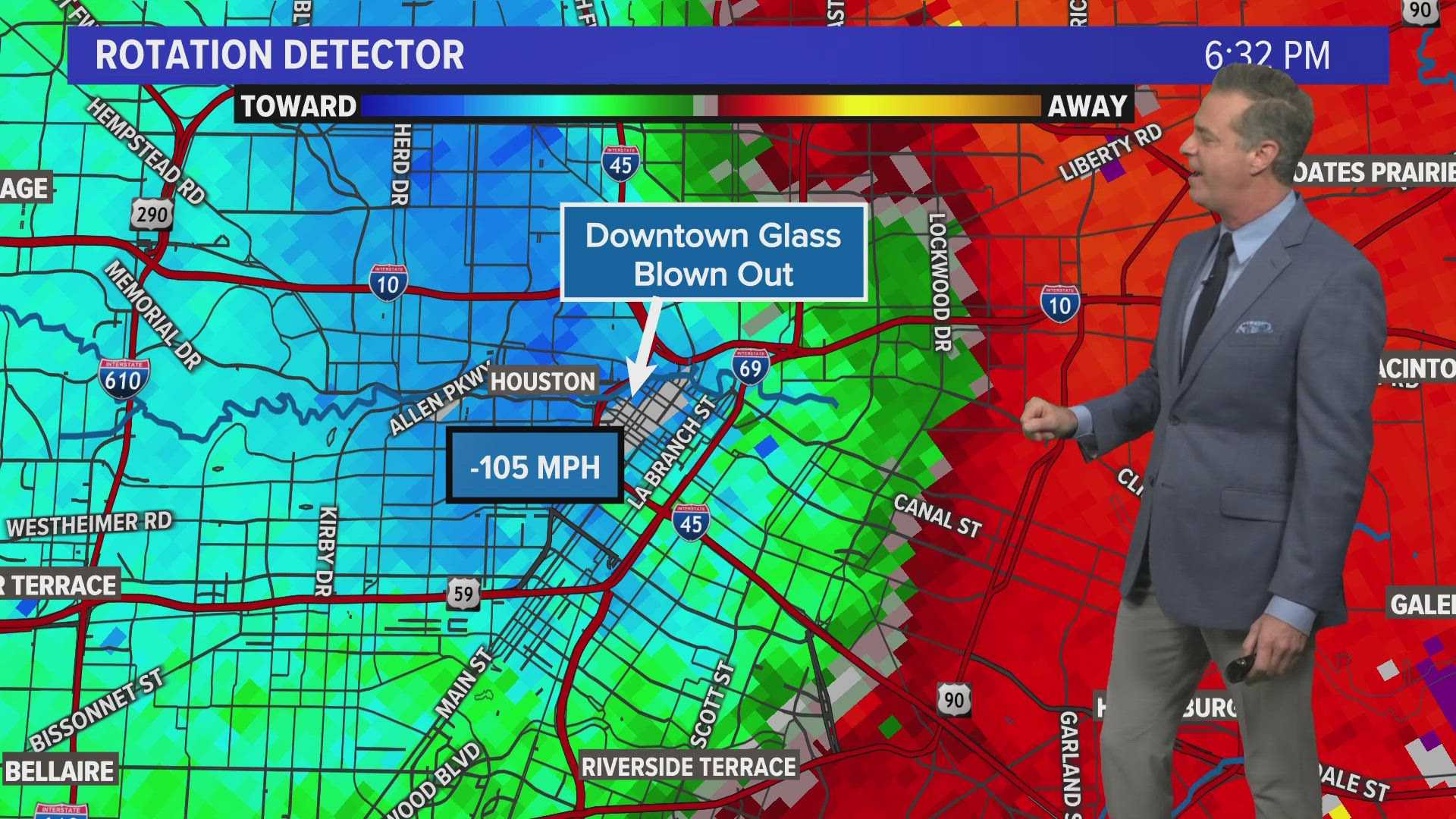
HOUSTON, TX — A Weather Impact Alert is in effect across Southeast Texas today, as strong storms are expected to develop Friday afternoon. The National Weather Service has issued a Severe Thunderstorm Watch until 8 p.m. for several counties, including Harris, Fort Bend, and Montgomery.
The alert highlights an “enhanced” risk for severe weather in the area, meaning a high likelihood of storms capable of producing hail and damaging winds. Meteorologists anticipate that the heaviest storms will arrive from early afternoon through evening.
More than three inches of rain are possible, raising concerns for localized flooding, particularly in urban areas. The Storm Prediction Center has categorized the Houston metro area under a Level 3 risk for severe weather, which may also include isolated tornadoes.
“We expect the strongest storms to form in the late afternoon and continue into the evening,” said a representative from the Gulf Coast Weather Authority. “Residents should be prepared for hazardous conditions.”
Severe Thunderstorm Warnings have already been issued for parts of northeastern Harris County and eastern Montgomery County, with storms moving in from Lake Houston. The severe weather may affect nearby cities including Navasota and Brenham before midnight.
Additionally, air travel disruptions have begun, with a ground stop at Bush Airport due to storm conditions, expected to last until at least 1:15 p.m. CDT.
Forecasts predict that the storms will diminish by Saturday, as drier conditions move into the region. Lows over the weekend are expected to drop into the low 60s, with highs reaching the mid-80s. Another round of storms may return by next Tuesday.


