News
Severe Storm Warnings Issued for Massachusetts This Weekend
BOSTON, Massachusetts — On Saturday, parts of Massachusetts are under severe storm warnings and watches as a series of thunderstorms are expected to impact the region.
The National Weather Service issued a severe thunderstorm warning for western Massachusetts, including Greenfield, Turners Falls, and Shelburne Falls, effective until 2:45 p.m. Additionally, a severe thunderstorm watch encompasses Franklin, Hampshire, Hampden, Worcester, and Middlesex Counties, along with parts of Connecticut, Maine, New Hampshire, New York, and Vermont until 8 p.m.
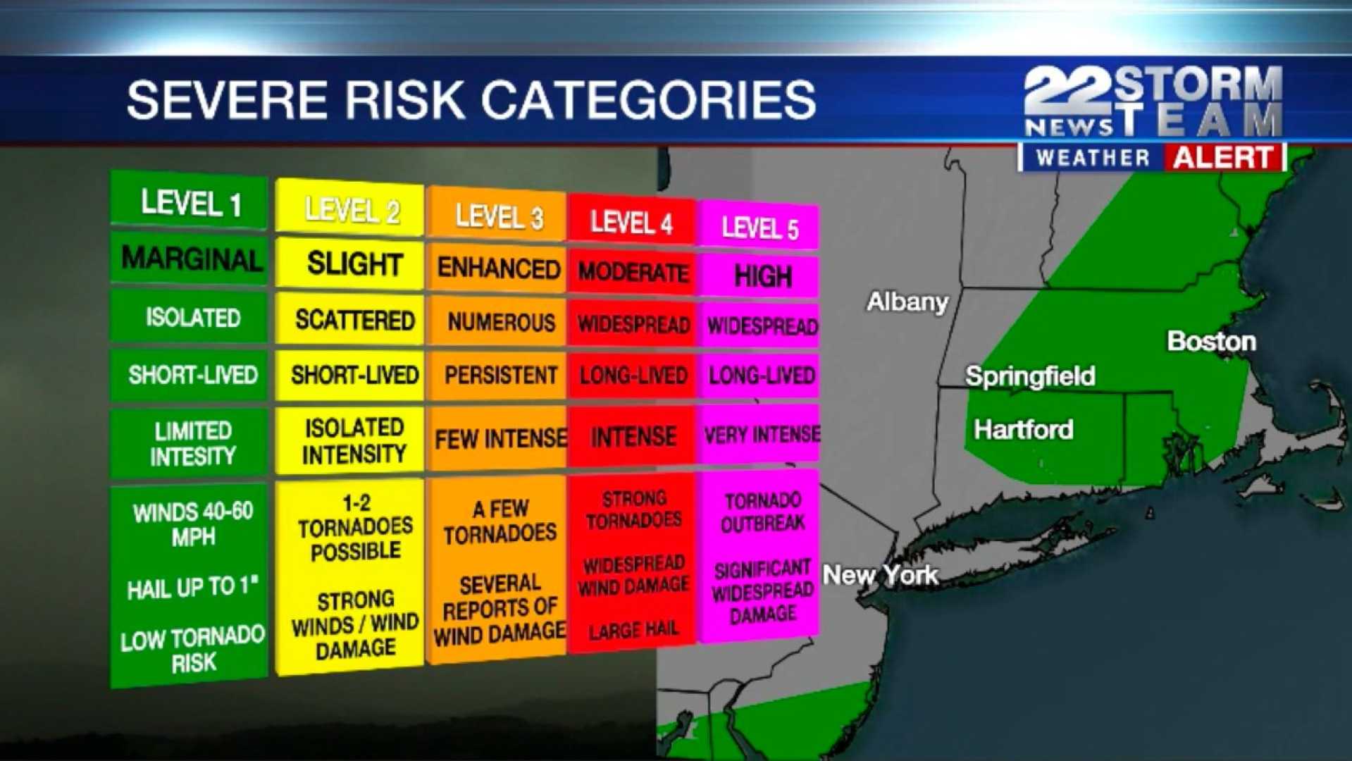
StormTeam 5 meteorologist Kelly Ann Cicalese reported a level 2 threat on a scale of 1 to 5 for severe weather in central and western Massachusetts and northeastern Connecticut. “Damaging winds, localized flooding, and heavy downpours with frequent lightning and hail are the main concerns,” Cicalese said. The potential for thunderstorms is expected to move into Boston later in the day.
As of Saturday morning, temperatures have reached the mid-80s, creating a summer-like feel with rising humidity. The threat of rain will persist into the evening, with storms anticipated to arrive in Boston around 9 p.m.
Going into Sunday, the forecast indicates a cloudy start with a slight chance of showers. Rainfall is expected to increase in the afternoon and continue into the evening, leading to widespread rain overnight.
The unsettled weather pattern will linger into the coming week, with additional showers anticipated from Monday through Wednesday. Temperatures are projected to cool from the 80s on Saturday to the 50s by Monday.
Cicalese noted, “The weather is going to stay active next week, with chances for showers throughout the week and possibly thunderstorms.”


