News
Severe Storms Expected in Northwest Ohio Wednesday Evening
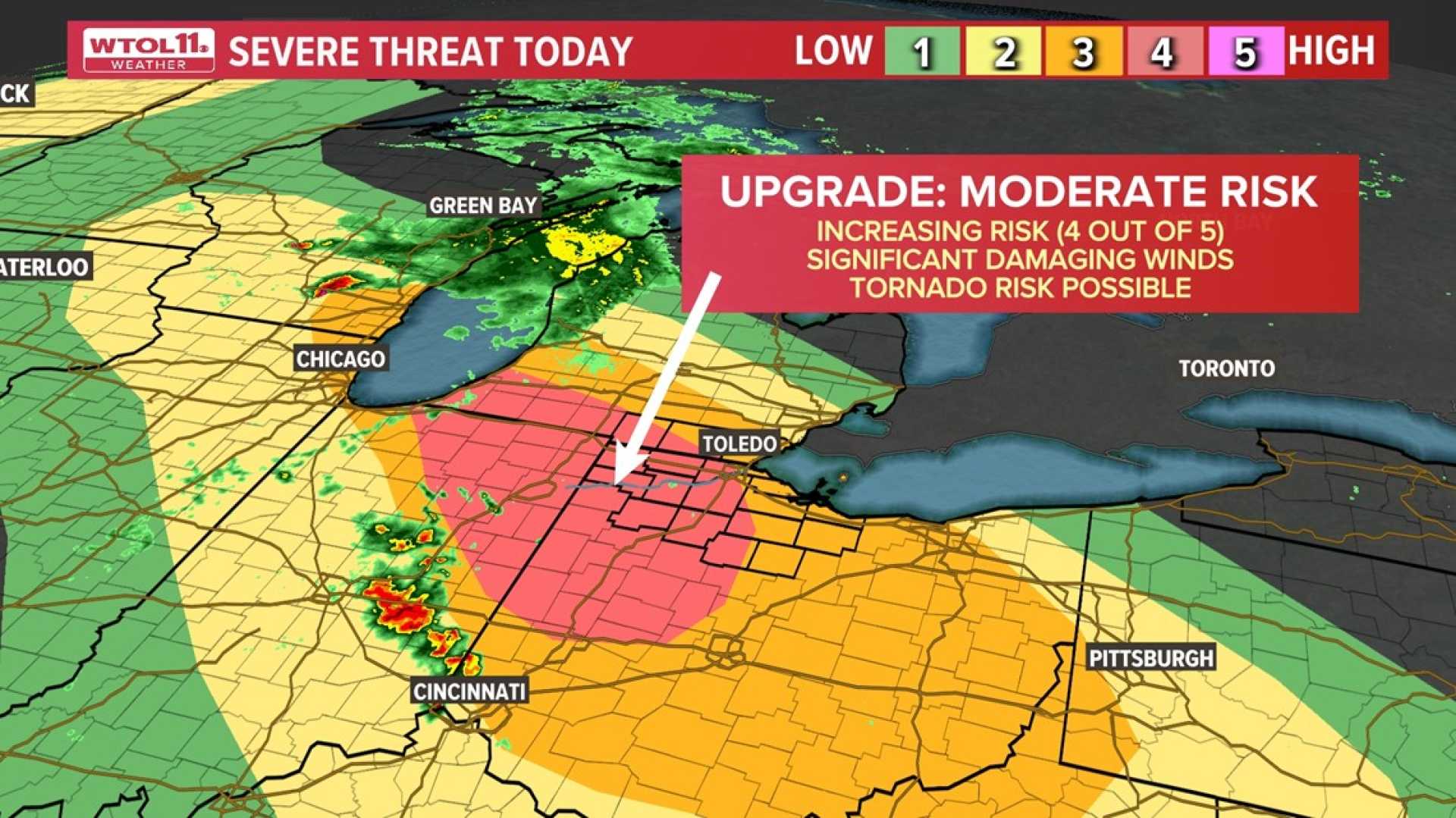
TOLEDO, Ohio — A severe weather threat looms over the region as the WTOL 11 Weather Team has issued a warning for strong to potentially severe storms anticipated on Wednesday night, June 18, 2025.
According to meteorologists, rounds of storms may begin around 4 p.m. on Wednesday and continue into the evening. The most intense activity is expected between 5 p.m. and 10 p.m.
Damaging winds are the primary concern, with gusts reaching up to 70 mph in some areas. In addition, large hail up to one inch in diameter and the possibility of tornadoes cannot be ruled out. As storms develop, they could weaken as they move east across the region.
The weather could start dry in the afternoon but warm and humid conditions are anticipated to create instability in the atmosphere, which is conducive for severe storm formation later in the day.
Multiple severe thunderstorm warnings have already been issued for several Indiana counties, including Allen, Huntington, and Whitley, until various times through Wednesday evening. Residents were advised to stay indoors and away from windows during storm activity.
In a statement, the National Weather Service cautioned, “If you live in the path of these storms, you should seek shelter immediately.”
Emergency preparedness is strongly encouraged; residents should ensure electronic devices are charged, prepare an emergency kit, and stay tuned to local weather updates.
The severe weather threat follows the cancellation of a Tornado Watch as conditions began to improve. However, the risk of severe thunderstorms remains high.
For ongoing updates and weather alerts, residents can download the WTOL 11 Weather App directly to their phones.


