News
Severe Storms Expected Across Southern Colorado This Afternoon
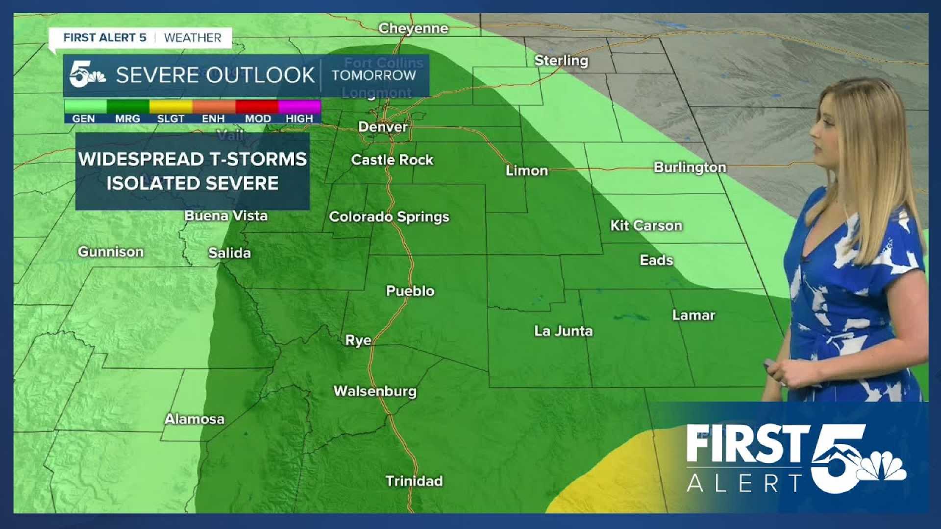
COLORADO SPRINGS, Colorado — Severe storms are expected to develop across Southern Colorado this afternoon, starting as early as the lunch hour. Meteorologists predict that the first round of storms will affect the Front Range, with the most significant severe weather window occurring between 1 p.m. and 6 p.m.
After a record heat Monday, a cold front is moving in on Tuesday, resulting in much cooler temperatures. Highs are expected to drop by 10-15 degrees across the region. For Colorado Springs, high temperatures will reach 79 degrees, while Pueblo will see a high of 88 degrees.
The Pikes Peak Region and I-25 corridor will face storms capable of producing 1-2 inch hail and wind gusts between 60 and 70 mph. Isolated tornadoes may also occur.
On the eastern Plains, the severe weather window extends between 4 p.m. and 8 p.m., when storms could produce hail as large as 2-3 inches and wind gusts up to 80 mph.
Residents are urged to stay alert for severe weather alerts as storms intensify throughout the afternoon. Weather forecasts for local towns include Canon City, which anticipates showers and thunderstorms moving across the Arkansas River Valley after lunch.
The Tri-Lakes area also faces a heightened threat for severe storms beginning around 12-1 p.m.
In the mountains, the severe weather threat will be much lower, with a possibility of showers missing the region entirely. Winds in the high country may reach 30-40 mph.
Weather conditions are expected to improve toward Wednesday, coinciding with the Western Street Breakfast event in downtown Colorado Springs. Temperatures will start at 50 degrees at 5:30 a.m. and will rise to around 65 degrees by 9 a.m. High temperatures are forecasted to climb back to the lower 80s on Wednesday.


