News
Severe Storms Expected During Derby Week in Louisville
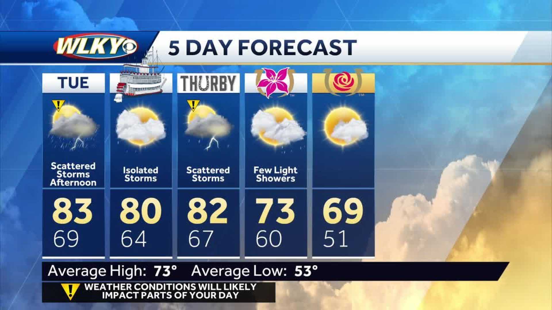
LOUISVILLE, Ky. — As Derby Week approaches, multiple chances for severe storms are forecasted in Louisville and surrounding areas. Meteorologists predict that rounds of showers and thunderstorms will begin Tuesday afternoon and may impact various events leading up to the Kentucky Derby.
Chief Meteorologist Jay Cardosi noted that after a warm and sunny start to the week with highs reaching the mid-80s, a cold front will trigger scattered storms. “This is the first significant rain chance we’ll see leading into Derby Week,” Cardosi said.
The National Weather Service has issued an enhanced risk of severe weather for Tuesday, ranking it level three out of five. Strong winds and large hail are the main threats as storms develop late in the day and into the evening.
Brian Neudorff, a meteorologist at the National Weather Service in Louisville, emphasized the importance of monitoring weather conditions leading up to the Derby. “We expect some storms to potentially turn severe, especially on Tuesday and Wednesday,” he said.
On Wednesday, further storms are likely, possibly bringing heavy rainfall. Another round of severe weather may arrive on Thursday, again raising concerns about flooding and storm damage.
Despite these weather concerns, early forecasts for Derby Day, May 3, indicate clearer skies with a high of around 69 degrees. Cardosi reassured that the weather should dry out in time for the main event, highlighting that the past five Derbies have been run on fast tracks.
Louisville Mayor Craig Greenberg has initiated a cleanup effort following recent floods, stating, “All roads impacted by the flooding are cleared and operational.” With the city preparing for a significant tourism influx during Derby festivities, residents and attendees are urged to stay informed about weather updates.


