News
Severe Storms Expected to Disrupt Holiday Travel in Texas
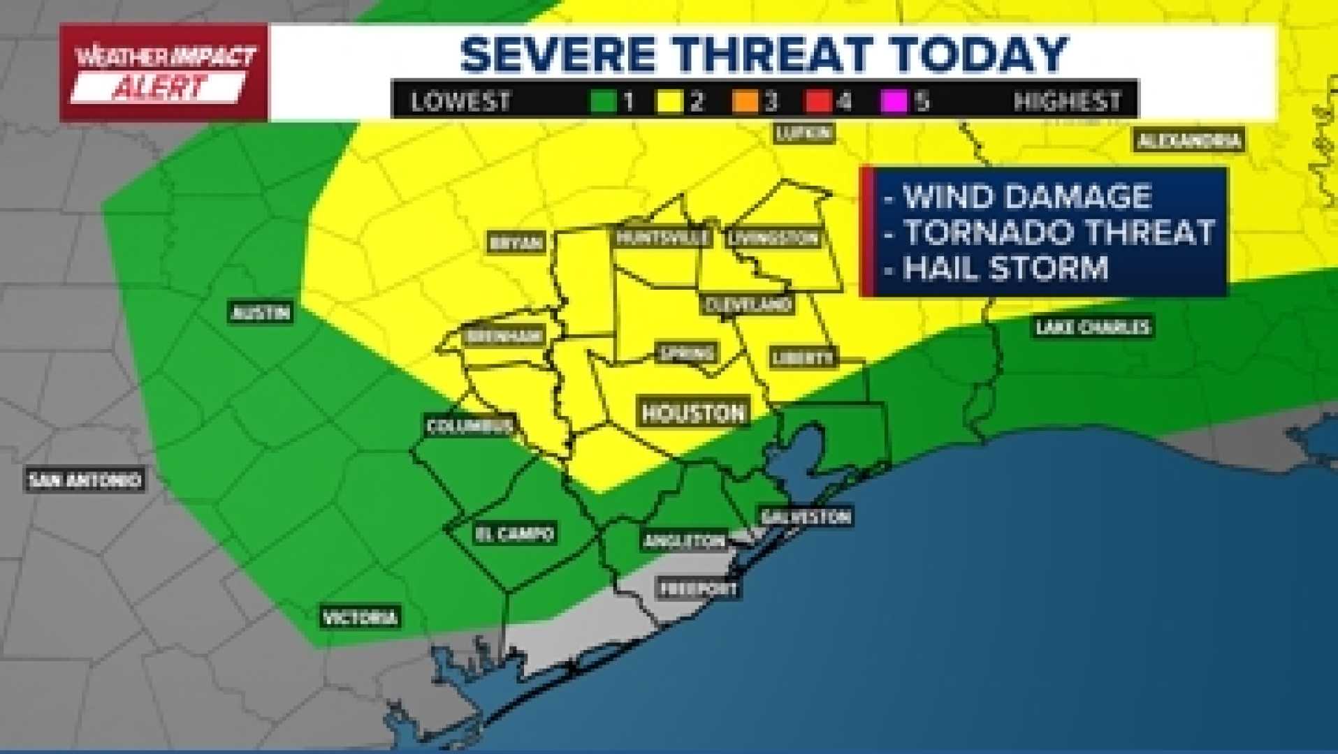
HOUSTON, Texas — The KHOU 11 Weather Team has issued a Weather Impact Alert for Monday, anticipating strong to severe storms late in the day. This weather could have significant effects on holiday travel across the region.
Forecasters predict a mix of damaging winds, isolated tornadoes, and hail late Monday evening into overnight hours. Most of the day will remain warm and humid, with light rain in the early afternoon. However, the risk for severe storms escalates sharply after sunset as a powerful storm system sweeps into Southeast Texas.
Light rain and isolated thunderstorms may begin as early as the afternoon, while the main storms are expected to hit College Station between 6 p.m. and 8 p.m., moving towards the Houston metro area by approximately 10 p.m. This storm line is predicted to clear the coast by sunrise on Tuesday.
Authorities warn that these severe storms could significantly interfere with both road and air travel, especially during one of the busiest holiday travel periods of the year.
The Storm Prediction Center has categorized most of the area, including Houston, under a Level 2 severe weather risk, urging residents to stay alert. Northern cities such as Huntsville and Livingston are predicted to experience storms first.
While flooding isn’t a major concern given the speed of the storm system, residents should prepare for strong winds and potential hail. Cooler and drier air is expected to follow the storm into Tuesday, leading into a calm Thanksgiving morning.
Travelers should check for any updates and delays as conditions may change rapidly. As the holiday approaches, staying informed on the weather will be crucial for safe travels.


