News
Severe Storms Expected to Hit Connecticut This Weekend
CONNECTICUT — A strong storm system is projected to affect Connecticut on Sunday evening, bringing heavy rainfall and damaging winds as the weekend winds to a close. Meteorologists from WFSB 3 TV report that while isolated showers may occur earlier, the likelihood of steadier, perhaps heavier, rain is set to increase after sunset.
“As the front gets closer Sunday, the wind gets stronger, and temps go even higher,” they stated, noting that wind gusts could reach or even exceed 40 mph.
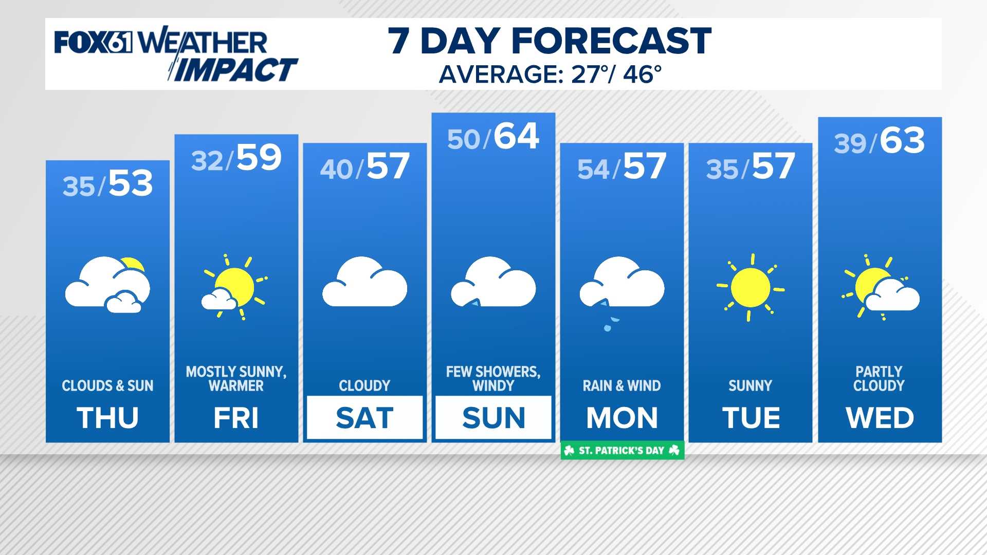
The National Weather Service has outlined the following forecast for Southern Connecticut: on Saturday, the day will start cloudy before becoming sunny, with a high near 52 degrees. By Sunday, expect a high near 59 degrees with rain likely after 2 p.m., accompanied by a south wind of 11 to 18 mph.
For Northern Connecticut, Saturday night is anticipated to bring a low of around 49 degrees post-rain. Meteorologists predict a 90% chance of precipitation, with new rainfall amounts estimated between three quarters and one inch.
The storm system has been affecting other regions before it reaches Connecticut. While tornadoes and destructive winds were reported in the Midwest and Southeast, those severe conditions are unlikely as the system approaches the tri-state area. The storm will push into New York City just before midnight.
As the storm progresses, heavy rain, potentially lingering into Monday, could impact the early morning commute and disrupt the start of events like the St. Patrick's Day Parade in New York City. Initial forecasts suggest that the storm should clear before the parade starts at 11 a.m.
Despite losing some of its severity by the time it reaches Connecticut, the storm still poses risks of isolated severe weather, particularly damaging wind gusts that could exceed 50 mph. These winds are threatening enough to bring down tree branches and power lines, according to weather experts.
Along with high winds, rainfall amounts could range from one to three inches across parts of the region, including low-lying areas vulnerable to flooding. Residents are advised to exercise caution and prepare for potential flooding scenarios.
The forecast includes some recommendations for commuters, particularly those traveling through flood-prone routes. Drivers are urged to allow extra travel time and consider alternate routes in anticipation of possible road issues.
As the storm moves into early next week, it is expected that showers could remain through Monday before clearing up, with highs expected to settle around 55 degrees. The overall regional impact will include a decent amount of rain, making necessary preparations critical for Connecticut residents.


