News
Severe Storms Expected Across the South this Weekend
BIRMINGHAM, Ala. (AP) — A First Alert Weather Day has been declared for Monday, March 31, as a significant storm system approaches the southern United States, including Alabama and surrounding regions. The storm is expected to bring severe weather from as early as 3 a.m. to 12 p.m. CDT on Monday, with the potential for localized flooding, damaging winds, large hail, and isolated tornadoes.
Residents are advised to prepare for a wet and windy commute on Monday morning, as forecasters predict up to 1.15 inches of rain. Following the storm, drier conditions and possible afternoon sunshine are expected later in the day.
According to the National Weather Service, the cold front associated with the storm will briefly lower temperatures into the 40s on Tuesday morning, with highs rising into the upper 70s later in the day. A warm front will lift through on Tuesday, ushering in unseasonably warm and muggy air, with temperatures potentially reaching the upper 80s by the week’s end.
The heat index could peak at 90 degrees due to increasing humidity levels. Rain chances will drop significantly to around 10-20% for the remainder of the week, but another storm system is predicted to impact Alabama next Sunday, potentially bringing rain back into the forecast.
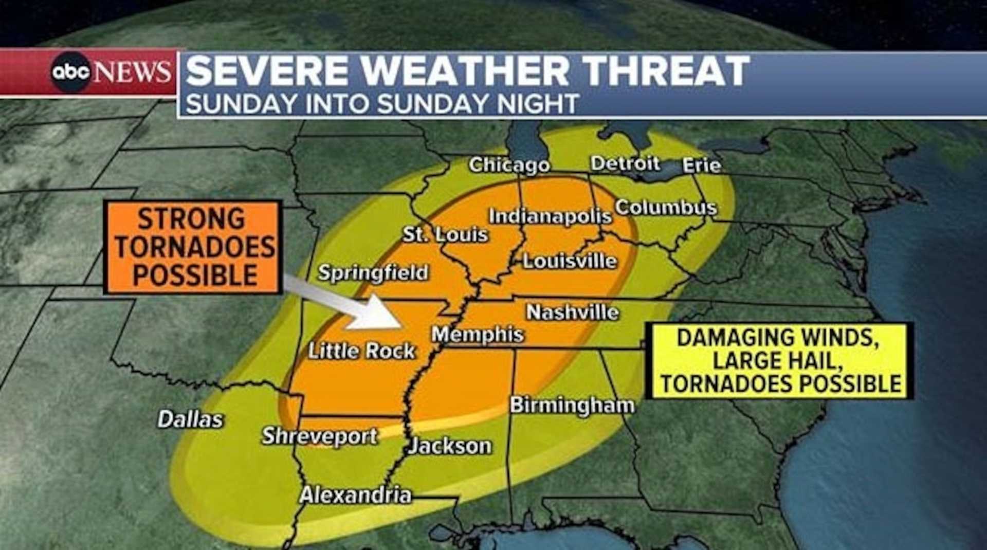
In Memphis, Tenn. (AP), officials have also issued a First Alert Weather Day as strong-to-severe thunderstorms are anticipated on Sunday evening and overnight. Mainly dry conditions are expected throughout the day, but storms are likely to develop after 4 p.m.
As thunderstorms move into the area around 8 p.m., residents of Northeast Arkansas, the Missouri Bootheel, and Western Tennessee are urged to remain vigilant. The storms could produce large hail, strong winds, and isolated tornadoes through the early hours of Monday morning.
“Plan for multiple ways to receive alerts during this time,” said WMC Meteorologist Eric Brill. “The severe weather threat should ease by Monday morning with clear conditions expected for the morning commute.”
Looking further ahead, another round of strong-to-severe storms is predicted for Wednesday evening, raising concerns about flash flooding as rain returns to the region throughout the week.
In Baton Rouge, La. (AP), heavy rain led to flooding and stalled vehicles on Saturday. The area is forecast to see clearer weather on Sunday, with temperatures reaching the 80s and a cold front expected to bring more thunderstorms Sunday night into Monday.
“Be prepared for another wave of severe storms potentially capable of producing damaging winds in the coming days,” said WAFB Weather Team’s meteorologists.
As communities across the South brace for extreme weather, local agencies remind citizens to stay informed and prepare for changing conditions this spring.


