News
Severe Storms Expected This Weekend in Chicago and Indiana
CHICAGO, IL — A warm front moving through the Chicago area this weekend is increasing the risk for severe weather, including damaging hail, high winds, and isolated tornadoes, on Sunday afternoon and evening.
According to ABC7 Chicago AccuWeather Meteorologist Jaisol Martinez, showers are expected to precede the main storm system on Sunday morning, with the peak threats occurring between 2 p.m. and 6 p.m. ABC7 Chicago AccuWeather Meteorologist Cheryl Scott warned, “The main threats will be damaging hail and high winds, with isolated tornadoes possible, particularly in areas farther south.”nn
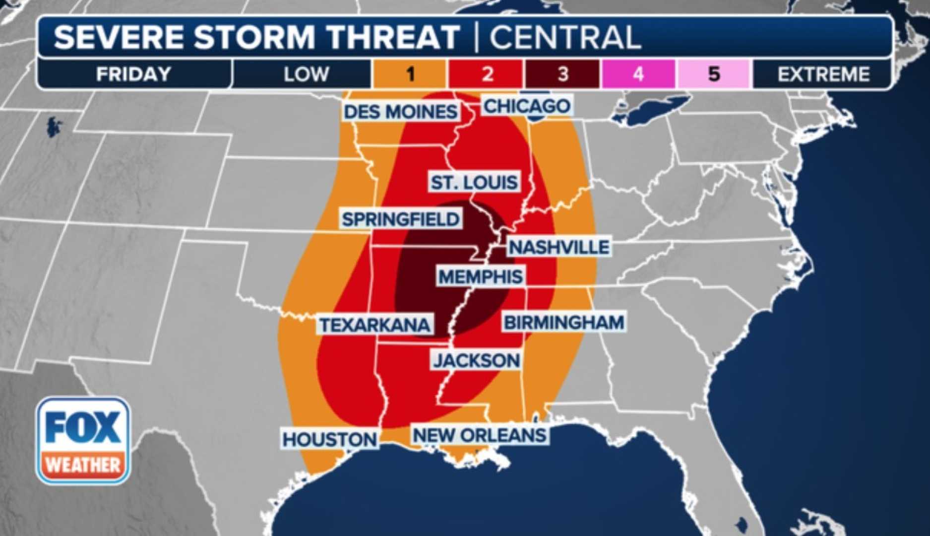
Most of the Chicago area is currently under a Level 2 risk for severe weather, while southern regions like Kankakee are under a Level 3 risk. The Level 1 risk extends to northern areas closer to Wisconsin. Temperatures are forecasted to reach the 70s on Friday and Saturday, cooling to the mid-60s by Sunday as thunderstorms approach.
In a similar forecast for Indiana, the state has been upgraded to a Level 3 severe threat for about 90% of its regions. The potential severe weather event is projected to impact the state from the afternoon into early evening on Sunday, March 30, where all types of severe weather, including high winds and tornadoes, are expected.
A warm front moving in Friday is creating instability as humid winds flow from the south, with highs in the 70s this weekend. A cold front’s interaction with this warm, moist air is anticipated to lead to widespread storms stretching from the Great Lakes to the Gulf Coast.
The Storm Prediction Center has placed much of the Ohio and Mississippi River Valleys, including central and southern Indiana, under a Level 3 Enhanced Risk. This broad designation suggests that some areas may experience light rain and thunder, while others could face intense storms.
As severe weather threats are rare to be forecasted this far in advance for Indiana, meteorologists are monitoring atmospheric conditions closely for further adjustments to risk zones. Michaela Hensley from WTHR stated, “The potential for severe storms means that we should be prepared for changing forecasts and impacts.”nn
Multiple rounds of rain and storms are expected on Sunday, and each round has the potential to strengthen the next. Therefore, time between the storm systems is critical — breaks in activity could allow for increased severity in subsequent storms.
The day is expected to start mostly cloudy with scattered showers, particularly in southern Indiana. While rainfall is expected, not all areas will see rain in the morning, as the warm front streams through. Peak heating in the afternoon could induce scattered supercell thunderstorms, which may rotate and produce severe weather including hail and tornadoes, contingent upon atmospheric stability.
By the evening, a primary line of severe storms is expected to sweep through Indiana, reminiscent of storm patterns seen earlier in March. This weekend also features numerous outdoor events that may be disrupted due to weather; organizers and attendees should prepare for possible delays.
As severe weather develops, officials urge the public to stay informed on changing conditions. Meteorologists emphasize that while some areas might only experience rain or thunder, others are at risk of facing damaging winds, large hail, and tornadoes.


