News
Severe Storms Expected This Weekend Across Midwest and South
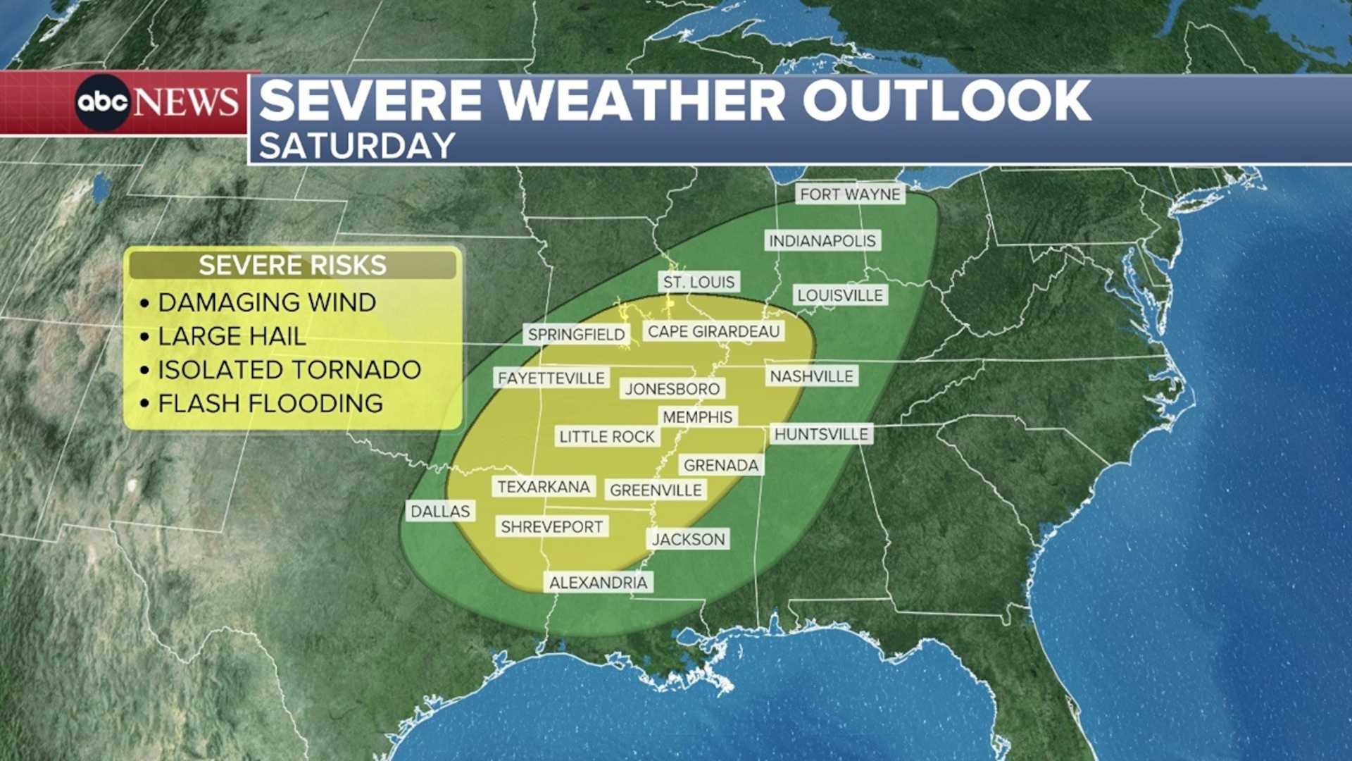
DALLAS – Severe storms are forecasted to hit the Midwest and South starting Friday night, with ominous conditions expected to last into the weekend. This weather system will bring tornadoes, hail, and heavy rainfall across several states, including Texas and Ohio.
Meteorologists are particularly concerned about a cold front moving through a warm and humid atmosphere, which is likely to create impactful thunderstorms. “These conditions are ripe for severe weather, particularly from late Friday into Saturday afternoon,” said meteorologist Jonathan Erdman.
Beginning shortly after 10 p.m. CST on Friday, a line of storms is expected to form from Oklahoma to Missouri, moving eastward. The severe weather threat will ramp up around 8 a.m. local time on Saturday. Areas such as St. Louis, Dallas, and Nashville are under heightened alert due to the expected severe weather conditions.
Forecasters predict that areas affected could receive between 1 to 2 inches of rain, potentially intensifying into flash flooding as the system moves east. The Storm Prediction Center has categorized areas north and east of Dallas as at a level 2 risk for severe thunderstorms.
As the weekend progresses, meteorologists advise staying weather aware, particularly on Saturday when the most severe conditions are anticipated. Winds may reach 60 mph, while hail could reach quarter size in some isolated storms. The storms are expected to clear by Saturday evening, allowing cooler air to flow into the region.
By Sunday, temperatures will drop, with highs in the upper 70s and lows in the 50s, signaling the arrival of fall weather. Monday may bring another frontal system, but without rain, temperatures are projected to rise again to near 90 degrees.
As always, residents are encouraged to stay updated on weather conditions and have a safety plan in place as potentially dangerous storms approach.


