News
Severe Storms Forecast for Indiana This Evening Amid Heat Wave
INDIANA, USA — A cold front is set to clash with the current heat and humidity in Indiana this evening, leading to potentially dangerous thunderstorms. The storms are expected to develop primarily between 5 and 9 p.m.
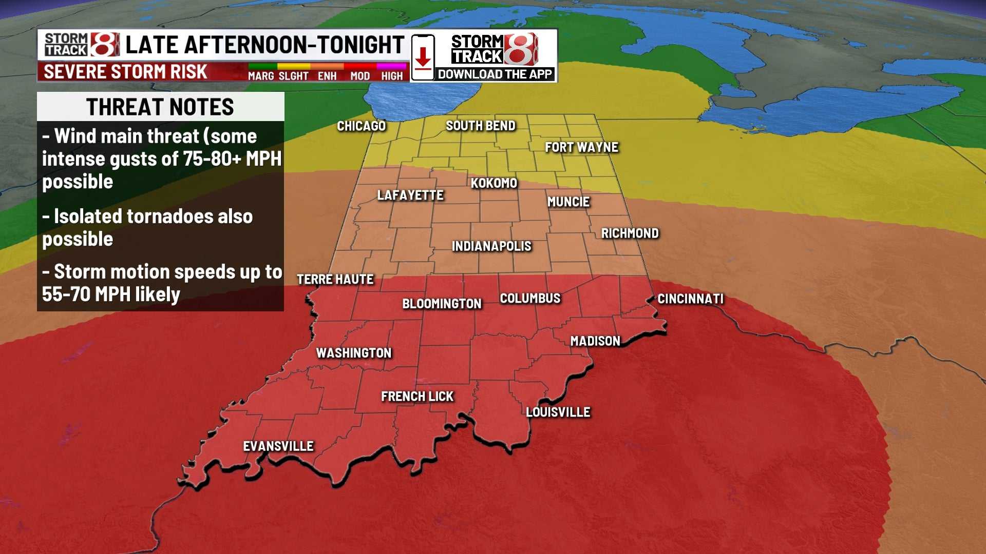
The National Weather Service warns that these storms could be severe, with the possibility of high winds exceeding 80 mph, large hail up to 2.5 inches in diameter, frequent lightning, and an isolated tornado threat, particularly in southern Indiana.
“The heat has been building, and it will provide fuel for these storms,” said a meteorologist. “While tornadoes are not the primary threat, we can’t rule them out, especially south of I-70.”
The areas at greatest risk include southern and central Indiana, with a Level 4 (Moderate Risk) for severe weather issued in parts of the south. Wind gusts over 80 mph can cause as much damage as weaker tornadoes, making this a significant concern.
The storms are expected to develop rapidly and may move in clusters, making it difficult to pinpoint exact timing. The wild weather is attributed to the extreme heat conditions, which can enhance storm intensity.
“Be aware and prepared, but don’t be scared,” the meteorologist added. “Stay tuned to local alerts and keep track of weather updates.”
The storms will likely move east and southeast across the state, with any storm that develops packing a significant punch. Most areas could remain dry, but any storm activity will be monitored closely.
This evening’s severe weather could mark the peak of a hot and humid week in Indiana, with temperatures reaching highs in the upper 80s to low 90s, making this one of the hottest days of the year so far.


