News
Severe Storms Forecasted for Indiana and Georgia This Week
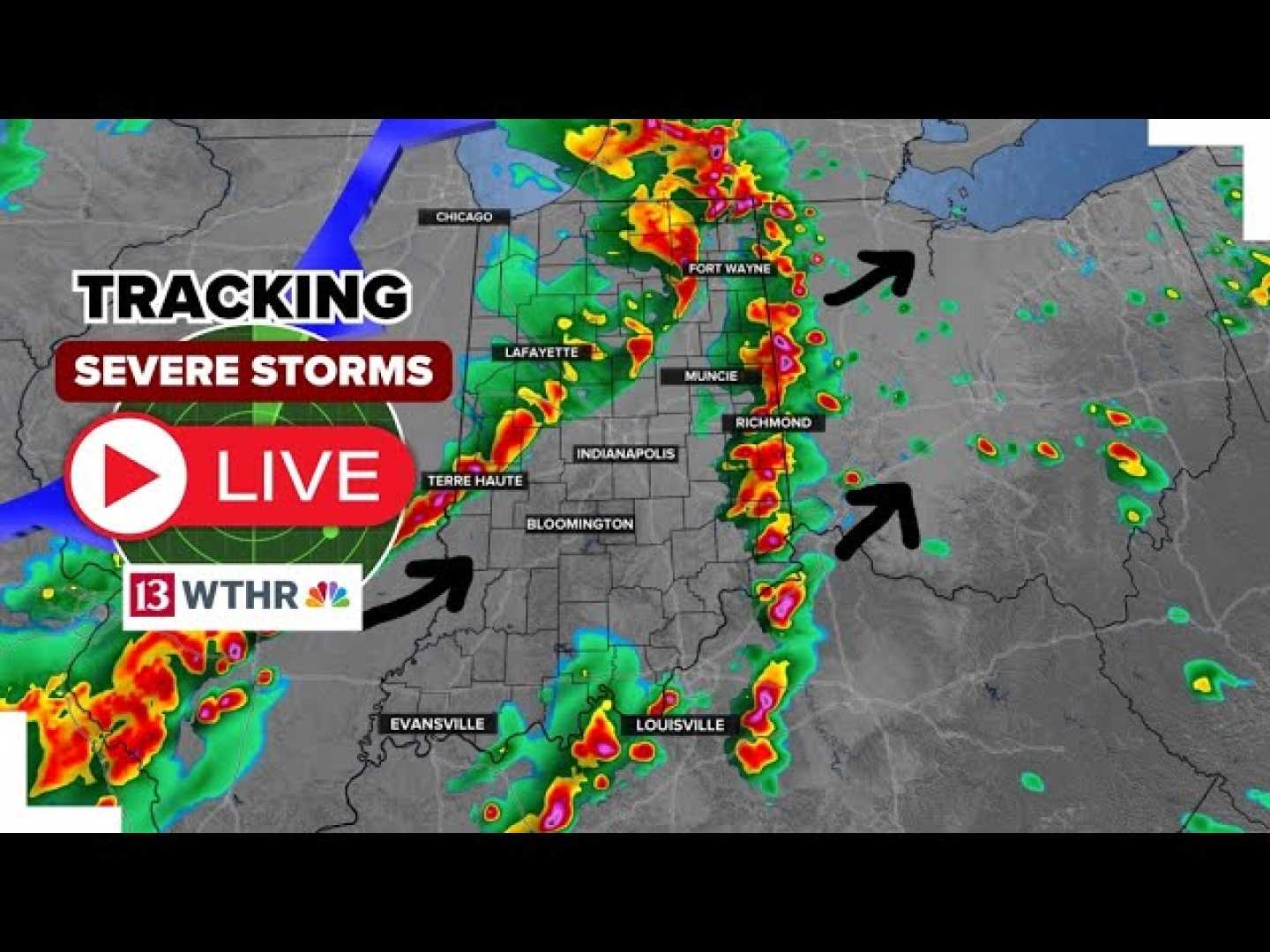
INDIANAPOLIS, Indiana — Severe storms are expected to develop this week across Indiana and parts of Georgia, as a combination of heat and humidity creates unstable weather conditions.
Currently, central Indiana is experiencing a mix of heavy rainfall and thunderstorms. The storms are slow-moving, which can lead to localized flooding. Forecasters note that while some areas have seen a break from the rain, new storm cells are expected to form later this evening.
The situation is due to a persistent upper-level low pressure system lingering over the Ohio Valley. This system leads to minimal daily changes in the weather. Rain and thunderstorms are anticipated again on Wednesday, with the most intense activity expected in the afternoon and early evening.
On Thursday, May 15, temperatures are likely to soar into the mid-to-upper 80s, combined with oppressive humidity. The National Weather Service has declared this day a Weather Impact Alert Day, warning of significant thunderstorms possibly producing damaging winds, large hail, and isolated tornadoes.
Across Indiana, there is a Level 2 risk for severe weather. Although not all regions will experience storms, forecasters caution residents to stay vigilant, as conditions are ripe for storm development after 6 p.m. on Thursday.
In Georgia, similar weather patterns are emerging. A Weather Impact Alert has also been issued for the afternoon and evening, as scattered thunderstorms are predicted. The storms may produce wind gusts of up to 60 miles per hour and potential quarter-sized hail.
Residents are encouraged to remain weather aware and ensure access to reliable sources for warnings, including local news apps and the National Weather Service. As we approach the weekend, warmer conditions will be followed by a shift to less humid and calmer weather.


