News
Severe Storms Hit Kentucky, Tornado Warnings Issued
LOUISVILLE, Ky. — Severe storms are sweeping across Kentucky and southern Indiana as tornado warnings have been issued for several counties, prompting residents to take cover. Storms are expected to develop later this afternoon into the evening and could be strong to severe.
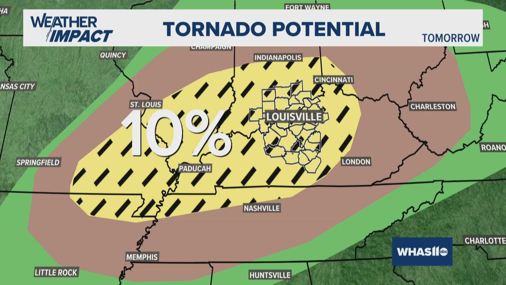
A tornado watch is in effect for the metro area and regions along I-65 until 11 p.m. local time, with the Storm Prediction Center placing the area under a moderate risk for severe weather—rated a level 4 out of 5. Officials advise locals to prepare for damaging winds, large hail, and the potential for isolated tornadoes.
Local meteorologists have indicated that heightened humidity and increasing temperatures will fuel thunderstorm activity throughout the day. The approaching storms could produce severe weather impacts as they move quickly eastward, reaching various cities, including Indianapolis and Cincinnati.
St. Louis officials are grappling with the aftermath of a devastating supercell storm that occurred Friday, where high winds and tornadoes resulted in the deaths of at least five people. Kentucky Governor Andy Beshear has declared a state of emergency as strong winds and the risk of flooding and tornadoes loom for the region.
The National Weather Service urges residents to stay safe and monitor updates. Emergency crews are on standby to respond to any weather-related incidents, and alerts through local stations such as WHAS11 and FOX19 provide ongoing coverage.
As the storms continue into Friday evening, officials will prioritize search and rescue ahead of the approaching weather system. Local authorities remind everyone to stay indoors during tornado warnings to ensure safety.
For anyone in affected areas, emergency management advises checking supplies and having a plan in place in the event of severe weather. Residents can expect calmer conditions as a cold front clears out the storms overnight.


