News
Severe Storms Loom Over Iowa Amid Changing Weather Conditions

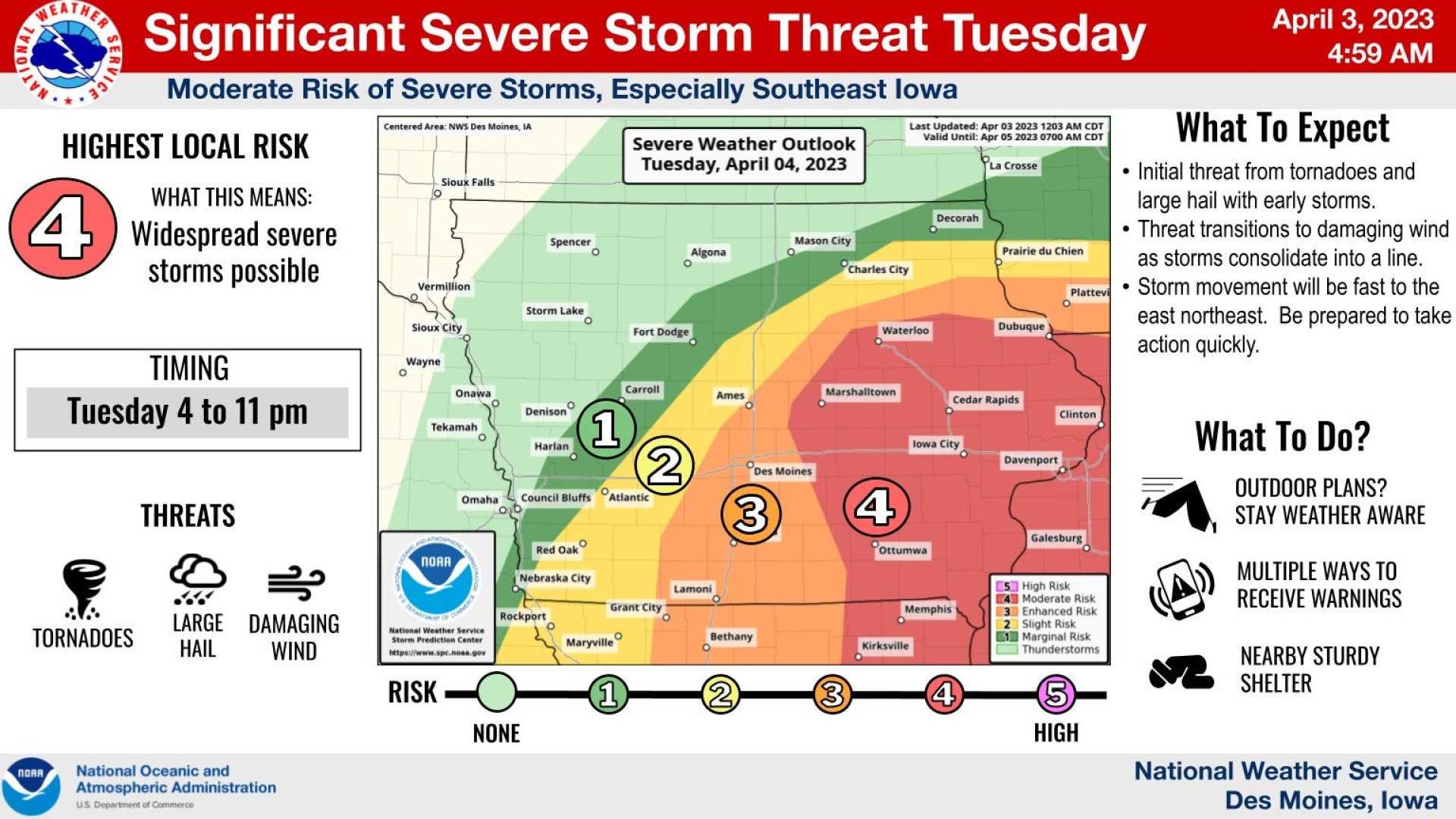
CEDAR RAPIDS, Iowa (KCRG) – A significant spring storm is forecasted to affect parts of Iowa, bringing potential for severe weather. The storm is expected to develop late this evening, with scattered showers and thunderstorms becoming likely after midnight.
Temperatures tonight will drop into the upper 20s to low 30s, but clouds will begin to thicken ahead of the storm. Winds are anticipated to pick up, gusting between 20 to 40 mph from the southeast throughout Tuesday, increasing humidity in the atmosphere which may contribute to storm development.
By the afternoon, isolated showers may begin in eastern Iowa, especially along and north of the U.S. Highway 20 corridor. With storms expected to move quickly from the southwest, areas along the Mississippi River could experience precipitation by 6:00 a.m. on Wednesday.
According to the Storm Prediction Center, conditions, while late at night not typically conducive to severe storms, could favor the development of strong storms capable of producing large hail, particularly in southern and southeastern Iowa.
“As we head into Wednesday morning, some scattered storms will linger, particularly impacting the southeastern third of Iowa during the morning commute,” said Chris Warner, a meteorologist with KCRG. “However, after that, we may see improvements in weather conditions.”
Late-morning clearing may allow temperatures to climb into the 60s, creating potential instability in the atmosphere. Should conditions align perfectly, this could lead to further storm development between 11:00 a.m. and 4:00 p.m. on Wednesday.
Warnings have been issued as the day develops, with large hail, damaging winds, and even an isolated tornado possible if storms materialize. As conditions progress, monitoring local weather updates remains crucial.
“If a storm approaches your area, seek shelter indoors and avoid windows,” Warner advised. “The best chance is to be in a basement or an interior room.”
By late afternoon on Wednesday, conditions are predicted to dry out, though strong winds will persist with gusts potentially reaching 40 mph. After the system passes, temperatures are expected to dip, falling into the 30s overnight.
For the remainder of the week, forecasts indicate a return to partly cloudy skies with slightly milder temperatures. While rain and storms may be possible on Friday and Saturday, the region is expected to remain largely dry if the storm system tracks further southeast.


