News
Severe Storms Possible Overnight in Kentuckiana
DAYTON, Ohio – The weather over Kentuckiana is heating up just as we head into the weekend, but residents should stay alert for possible severe storms Friday evening. The Storm Prediction Center has issued warnings across nearly the entire viewing area, with threats of strong winds and heavy rain.
A Severe Thunderstorm Watch was active from Friday evening into Saturday morning but was canceled around midnight. Although the warnings have expired, forecasters urge everyone to remain cautious and monitor conditions throughout the night.
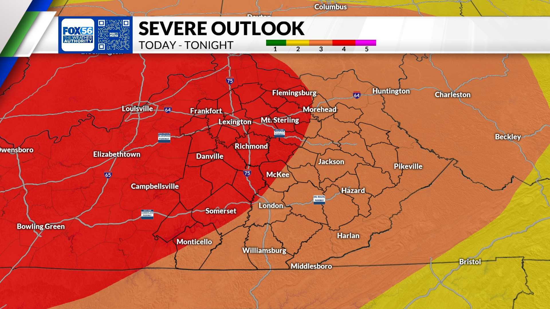
Most areas are categorized under a risk level by the Storm Prediction Center, with the regions in yellow indicating a level 2 risk, which suggests scattered severe storms may occur. An area in orange indicates a level 3 risk, while the most severe threat lies across parts of Southern Illinois and Kentuckiana, where a level 4 risk is outlined.
Storms may bring damaging winds, large hail, and even potential tornadoes. Forecasters warn of hit-or-miss storms from late afternoon into the evening hours. Conditions are expected to last until shortly before sunrise on Saturday.
The weather may change quickly, so those with evening plans should have access to weather alerts. It’s advisable to stay informed of the forecast, especially as radar updates are made hourly.
Looking ahead, the threat of severe weather decreases on Saturday, but a cold front will bring notably cooler temperatures. Spotty showers are possible Saturday afternoon, although Sunday is predicted to be dry and cool.


