News
Severe Storms Ravage Nebraska and Iowa: Tornadoes, Hail Reported
OMAHA, Neb. (WOWT) – The National Weather Service (NWS) has completed its assessment of tornadoes and large hail that struck eastern Nebraska and western Iowa on April 17. Two powerful supercells moved through the region during the afternoon and evening, causing dramatic weather events.
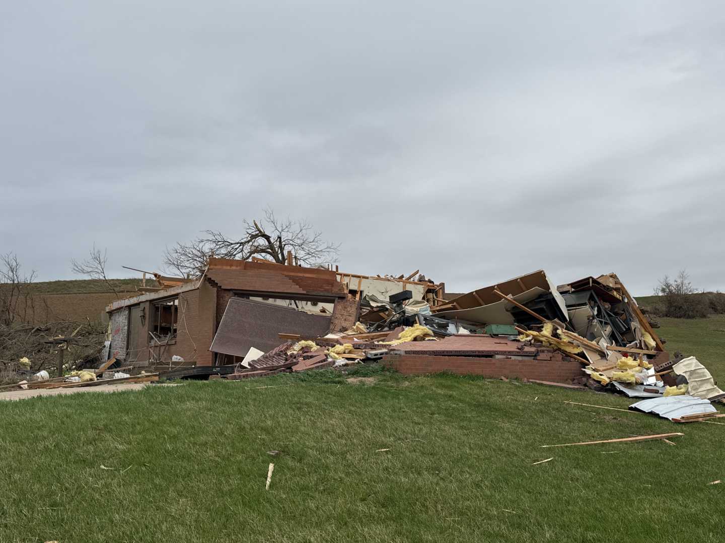
The strongest tornado, rated EF-3, touched down in the Bennington/Ft. Calhoun area, just north of Omaha, at 6:55 PM. It was on the ground for approximately 20 minutes, with wind gusts estimated at 140 mph. The tornado caused significant damage along Dutch Hall Road near 84th Street, impacting homes, trees, and businesses.
Another tornado, rated EF-1, formed near Imogene, Iowa, and tracked into the northern part of Essex. This tornado exhibited a remarkable width of over a mile and reached maximum wind speeds of 110 mph. It caused damage to trees and buildings, particularly in the area south of Imogene.
Weather patterns across the metro also included extensive hail damage. Reports indicated hail sizes reaching up to 4 inches, with the largest hail observed in Arlington, Nebraska. Many reports documented hail measuring between 2 and 3 inches in diameter.
Wind gusts during the storm reached between 70 and 80 mph, leading to considerable damage in places like Fremont, Nebraska. Fortunately, the NWS has noted that no major injuries or fatalities resulted from these storms.
Meteorologists confirm that the system was characterized by two long-lived supercells that generated both the tornadoes and severe hail.


