News
Severe Storms Sweep Through Oklahoma, Leaving Hail and Heavy Rain in Their Wake
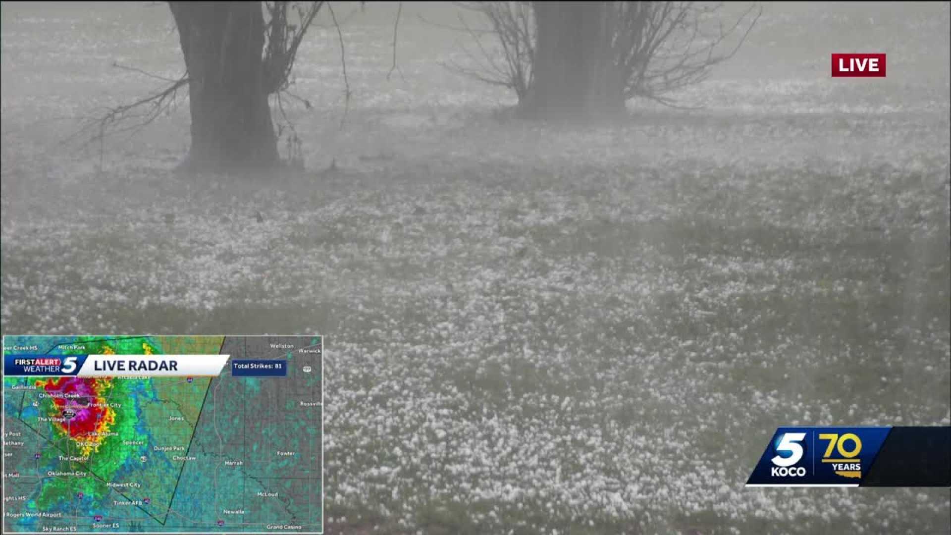
OKLAHOMA CITY, Okla. — Severe thunderstorms moved across Oklahoma early Saturday, bringing large hail and heavy rain that resulted in multiple warnings and watches throughout the state.
The National Weather Service issued severe thunderstorm warnings for counties including Seminole, Pontotoc, and Hughes, detailing threats of quarter-sized hail and winds gusting up to 70 mph. The warnings were active until early morning, with areas such as Oklahoma City and Edmond expected to face severe weather shortly after midnight.
As of 12:50 a.m. Saturday, the NWS reported that the severe thunderstorm warning for southern Seminole County entered effect and was expected to expire at 1:30 a.m. With the potential for quarter-sized hail, affected communities included Allen, Dustin, and Horntown.
Chief Meteorologist Damon Lane of KOCO 5 noted that instability in the atmosphere could prolong the storms’ presence in the region. “We may see ongoing showers and rumbles of thunder through the evening,” Lane remarked during his broadcast.
The tornado watch for Pottawatomie and surrounding counties remains in effect until 4 a.m. Saturday, with populations advised to stay alert for potential development of tornado conditions. The initial severe weather risks were anticipated late Friday evening, primarily affecting the southwestern and central Oklahoma regions.
In light of the severe weather outlook, Lane cautioned local farmers about the impact on crops, especially wheat. “The wheat crop is starting to put on heads, and they definitely need some rain to help make those heads a little bit bigger,” he explained while discussing the mixed blessings of heavy rain.
Despite the immediate threats, forecasts indicated a significant amount of rainfall over the next few days. Some areas could receive as much as 5 to 6 inches, which raises concern for flooding conditions. The NWS expanded flood watches from Friday afternoon through Sunday for numerous counties in Oklahoma, encouraging residents to prepare for possible flash flooding.
“This is a critical time of year, and we are advising precautions during storm watches,” said Lane. “Monitor updates as conditions can change rapidly.”
Earlier Friday, warnings noted possible hail up to the size of baseballs in southwestern Oklahoma, with specific warnings of even larger hail—reaching golf ball sizes—along with potential for a tornado index of 4 out of 10 in eastern Oklahoma within the storm risk zones.
Communities have begun reporting incidents of hail damage, with estimates indicating that significant weather could last through the weekend. Lane concluded the segment by emphasizing the importance of staying informed and having a weather plan in place.


