News
Severe Storms Threaten Millions Across Central US
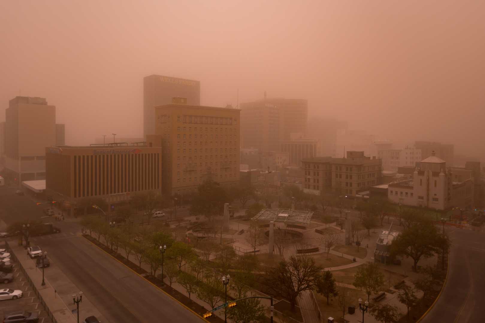
EL PASO, Texas — A severe storm system has swept into the central United States, putting millions at risk of hazardous weather just days after a similar system caused widespread destruction. Forecasters warn of powerful winds, blizzard conditions, and increased wildfire risks.
The storm moved into the Plains region early Wednesday morning and is expected to intensify throughout the day as it heads toward the Midwest. Strong winds whipped up dangerous dust across parts of Texas and New Mexico on Tuesday, leading to visibility issues and dangerous conditions.
The National Weather Service reported wind gusts exceeding 40 mph from Texas to Minnesota, with gusts capable of causing significant damage to trees and power lines. Fire weather conditions have reached a critical level in parts of New Mexico, Texas, and Oklahoma, with a level 3 of 3 risk in effect.
According to the Storm Prediction Center, strong winds have created optimal conditions for wildfires. “Vegetation is primed for ignition, and with wind gusts potentially reaching up to 60 mph, any spark could turn into a dangerous blaze,” the Center warned.
Among the new fires ignited by these conditions is the Double S Fire near Borger, Texas, which authorities fear could result in significant property and life loss. Additionally, Otero County, New Mexico, issued evacuations for residents north of US Highway 82 after fire agencies responded to a vegetation fire.
“The fire was able to move through a field, into some heavier brush, then into some structures,” said Matt Propp, Valencia County Fire Chief, in reference to a brush fire that impacted part of Highway 47 in Bosque Farms, New Mexico. “On days like this, any source of heat can ignite fires like these, and they can explode rapidly.”
Dust storms have also created hazardous conditions, with warnings issued across New Mexico and Texas. Visibility dropped dramatically as winds gusted above 50 mph, prompting closures of interstate roads, including a nearly 130-mile stretch from Arizona to Las Cruces, New Mexico. “There is no safe place on a highway when a dust storm hits,” a spokesperson for the National Weather Service cautioned.
This series of storms continues a troubling trend as spring approaches, bringing conditions that promote severe weather. Just last week, tornadoes caused numerous fatalities in a violent outbreak, leading to similar dust storm conditions.
In recent days, more than 130 wildfires in Oklahoma damaged at least 400 homes and resulted in four fatalities, according to the state’s Department of Emergency Management. A new storm system exacerbates fire threats just as recovery efforts from prior storms get underway.
Simultaneously, snowfall has started across parts of the Midwest, with blizzard warnings issued from northeastern Nebraska to Michigan’s Upper Peninsula. Accumulations of more than six inches are forecast in some heavy snow zones. Wind gusts exceeding 50 mph could lead to whiteout conditions and dangerous travel across the region.
The impending blizzard poses significant hazards. “Travel in blizzard conditions could be treacherous and potentially life-threatening,” warned the National Weather Service in Des Moines, Iowa. “Snowfall rates may exceed two inches per hour, and gusty winds could lead to zero visibility.”
As the storm sweeps through, severe thunderstorms may develop from the Midwest to the Gulf Coast, adding to the tumultuous weather patterns. Though the severe threats may not be as extensive as previous tornado outbreaks, localized hail and damaging winds are still a concern.
Overall, the central U.S. faces an increasingly volatile weather situation that continues to pose dangers to life and property as instability builds through this week.


