News
Severe Storms Threaten Philadelphia Region This Saturday Evening
PHILADELPHIA, PA – A NEXT Weather Alert has been issued for the Philadelphia area on Saturday evening due to potential severe storms that may bring damaging winds, hail, and a low-end tornado risk. The alert took effect at 4 p.m. and will remain in place until midnight.
The National Weather Service has issued a severe thunderstorm watch for several counties in the Delaware Valley until 11 p.m. This includes New Castle in Delaware, Atlantic, Burlington, Camden, Cumberland, Gloucester, Ocean, Salem, and Mercer in New Jersey, along with Bucks, Chester, Delaware, Montgomery, Philadelphia, Berks, Lehigh, and Northampton in Pennsylvania.
Despite being early May, temperatures on Saturday reached the mid-80s, feeling more like July. By late afternoon, the atmosphere became unstable ahead of a cold front. Conditions could support scattered storms, some of which may become severe.
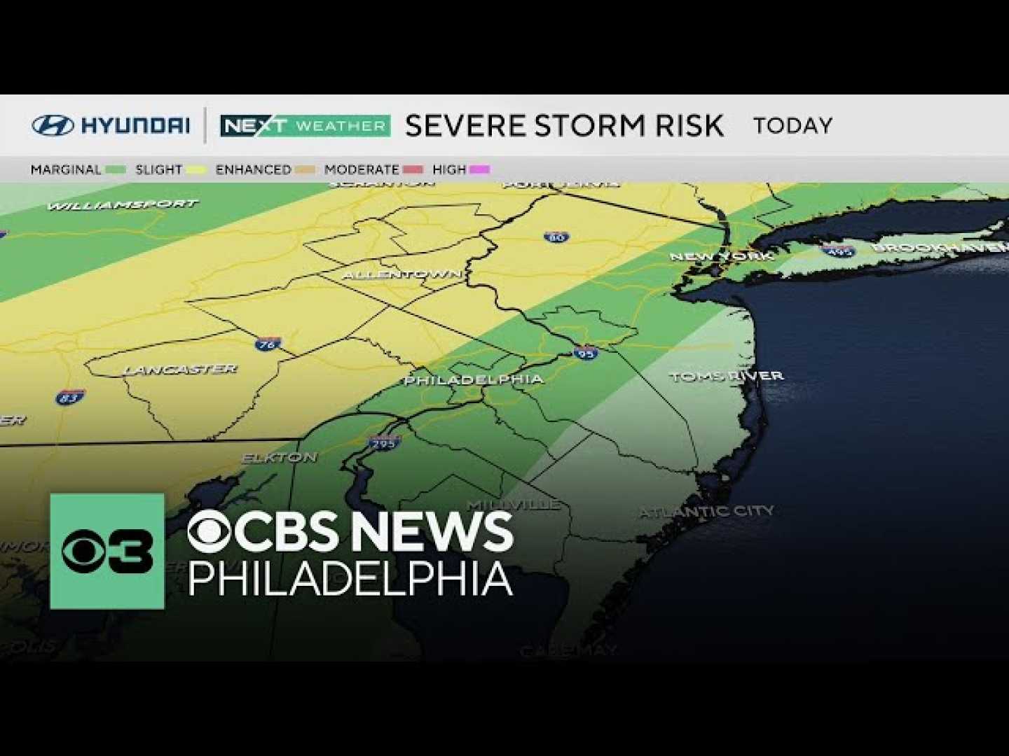
The greatest threat is located northwest of the city. The Storm Prediction Center has designated the Lehigh Valley, Poconos, Chester County, and parts of upper Bucks and Montgomery counties as experiencing a Level 2 or “slight” risk of severe weather. Areas closer to the Delaware River, including Philadelphia and surrounding counties, are classified under a Level 1 or “marginal” risk.
Forecasters caution that not everyone in the area will experience storms. The most significant chance for severe weather is forecasted for the I-95 corridor extending north and west across southeastern Pennsylvania. A low-end tornado risk is present for the northwest region of the city, with potential impacts including isolated downed trees and power lines.
Travel may also be affected, particularly at Philadelphia International Airport, and there is a possibility of delays or cancellation for the Phillies game at Citizens Bank Park, which may see rain move in during the middle to late innings. However, the earlier part of the game could remain clear.
Looking ahead, the weather this weekend indicates a mild transition with temperatures in the low to mid-60s expected on Sunday, alongside afternoon showers. The following week will continue with unsettled weather patterns, featuring chances for showers and storms on Monday, Tuesday, and again on Thursday and Friday. By the end of next week, accumulated rainfall could help alleviate ongoing drought conditions.
Saturday’s forecast shows a warm day with a high of 85°F and a low of 65°F. Sunday is expected to be cooler with clouds and afternoon showers, a high of 73°F and a low of 64°F.


