News
Severe Storms Threaten Plains and Midwest with Hazardous Weather
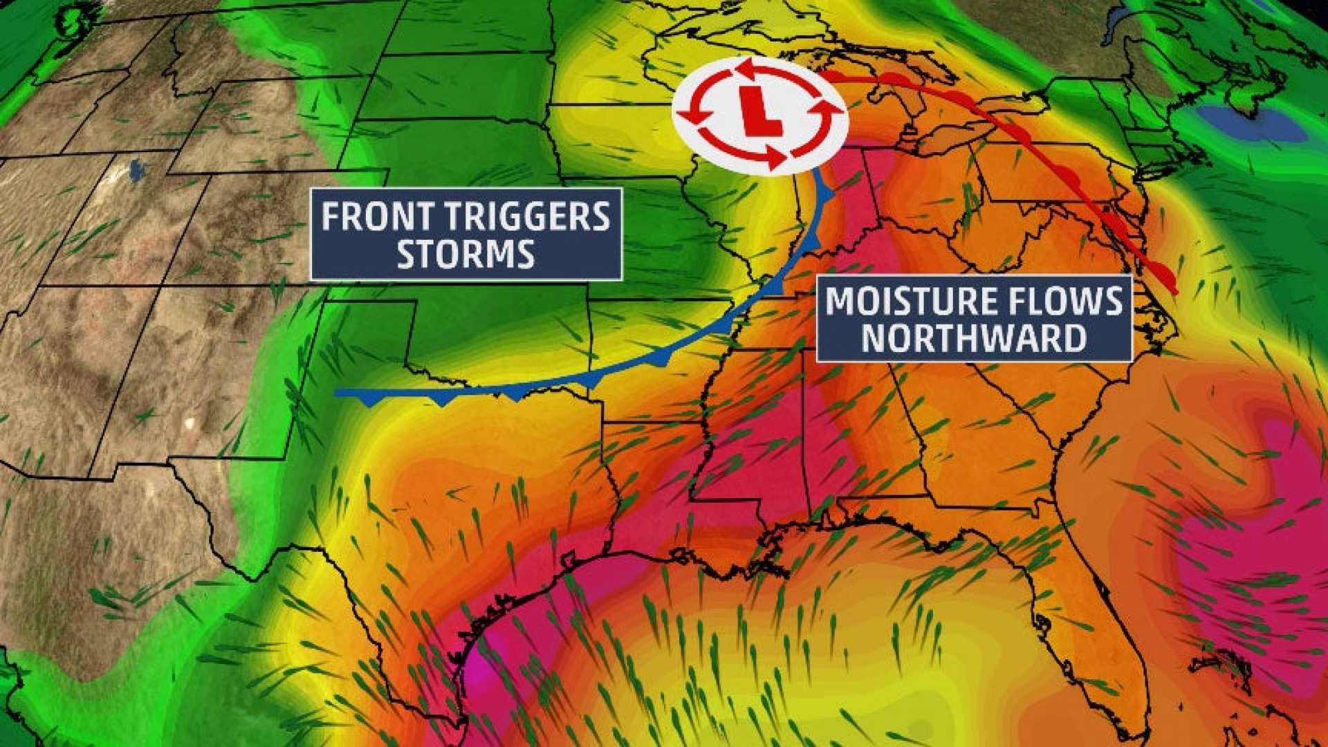
KANSAS CITY, Mo. — A powerful storm system is set to impact the central United States on Tuesday, bringing a dangerous mix of rain, snow, and severe thunderstorms across the Plains and Midwest. Meteorologists are warning of wind gusts reaching up to 70 mph, which could lead to hazardous driving conditions and widespread power outages.
The FOX Forecast Center reported that as the storm progresses eastward, it will cover more than 10 million people in its path. The severity of the weather will vary across regions, creating a ‘mixed bag of hazards,’ said FOX Weather Meteorologist Robert Ray.
Severe Thunderstorm Warnings are issued across several states, highlighting areas at risk for damaging winds and tornadoes, particularly on Tuesday, which is expected to feature the most severe weather during this multiday event. Heavy snowfall is also anticipated, with parts of Colorado and Kansas under Blizzard Warnings, where visibility could drop to near-zero.
In Lewisville, Texas, a roof collapse at the Benjamin Moore Paint warehouse was reported Tuesday morning, with debris scattered across Highway 121. Video captured the damage, showing walls missing and insulation traveling with the wind. Details on injuries have yet to be confirmed, but local authorities are urging residents to remain vigilant.
The storm system, which developed over the Rockies late Monday, is expected to intensify as it moves towards the Great Lakes by Wednesday. Areas from central to eastern states are bracing for significant snow accumulation, particularly in mountainous regions where snowfall may exceed a foot.
Goodland, Kansas, has already begun experiencing snowfall, prompting officials to advise against travel in the affected areas. Snowfall could be accompanied by wind gusts over 60 mph, leading to whiteout conditions and potential blizzard scenarios. The FOX Forecast Center strongly discourages travel during peak storm conditions, especially in the Palmer Divide region.
As the storm moves eastward, a second wave of severe weather is expected on Wednesday, impacting the Eastern Seaboard with additional rain, gusty winds, and a risk of thunderstorms. Rain amounts are estimated at 1-2 inches in the Northeast, which could lead to localized flooding, particularly along the Interstate 95 corridor.
Fire conditions are also of concern, with winds expected to sustain at 30-40 mph across the Southwest, raising the risk of fire outbreaks in extremely dry conditions. Fire warnings have been issued in parts of Texas and New Mexico as Xcel Energy begins implementing power shutoffs for safety.
In the midst of these preparations, Mardi Gras festivities in New Orleans continue, although officials are urging celebrants to remain alert as severe weather approaches later in the day.
The FOX Forecast Center is continuously monitoring the situation and will provide updates as conditions evolve, urging everyone in affected areas to remain cautious and prepare for rapidly changing weather.


