News
Severe Storms and Tornado Watch Hit St. Louis
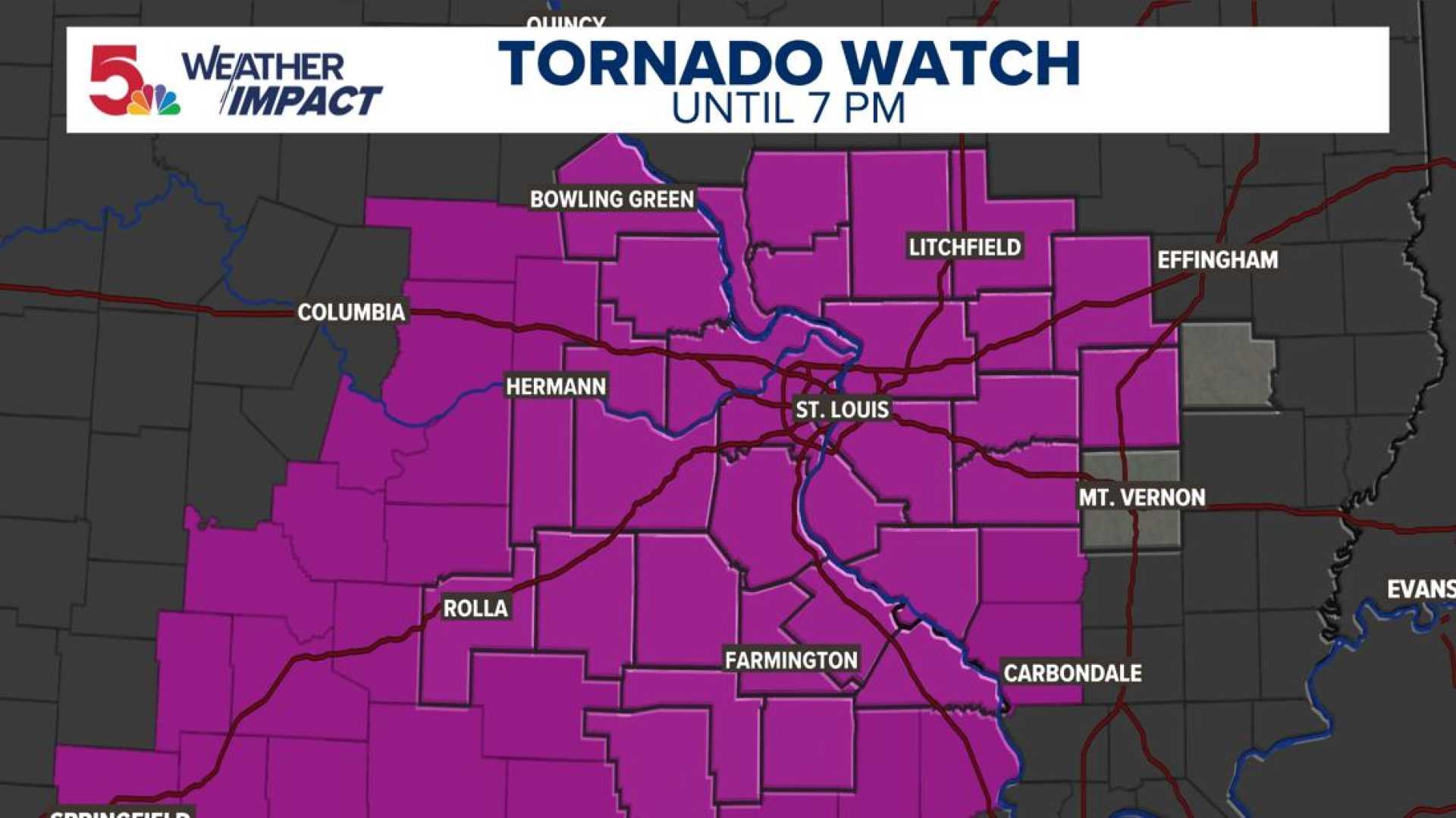
ST. LOUIS — A tornado watch is in effect as severe storms are expected Friday, bringing potential brief tornadoes and large hail to the area. The watch was issued from 1 p.m. to 7 p.m. due to forecasts of severe weather.
Weather radar confirmed softball-sized hail in St. Charles County at 2:20 p.m., highlighting the severity of the storms moving through the region. The 5 On Your Side Weather Impact team has warned that brief tornadoes and significant hail are possible throughout Friday afternoon.
The Storm Prediction Center has raised the threat level for the area to a four out of five, indicating a moderate risk for severe weather. The primary concern is large hail, which could lead to costly damages.
“Our main reason for issuing a Weather Impact Alert Day is to prepare residents for potentially impactful and disruptive weather,” said a meteorologist from the team. “The risk of intense winds and tornadoes appears greatest to the southeast of St. Louis.”
Conditions are expected to worsen later in the afternoon as moisture returns northward. A cold front moving from southeast Kansas will contribute to an unstable atmosphere, increasing the likelihood of severe storms starting midday.
The main threats include large hail, potentially up to baseball size. While there is some chance for tornadoes, meteorologists anticipate that only a few storms will form, but they are likely to be severe.
“We expect highs in the 80s, with middle 80s in Arkansas. By Saturday, conditions will dry out as the cold front settles,” the forecaster added. Scattered storms may return Saturday night into Sunday, with more potential severe weather anticipated early next week.


