News
Severe Thunderstorm Alerts Issued Across Heartland Region Today
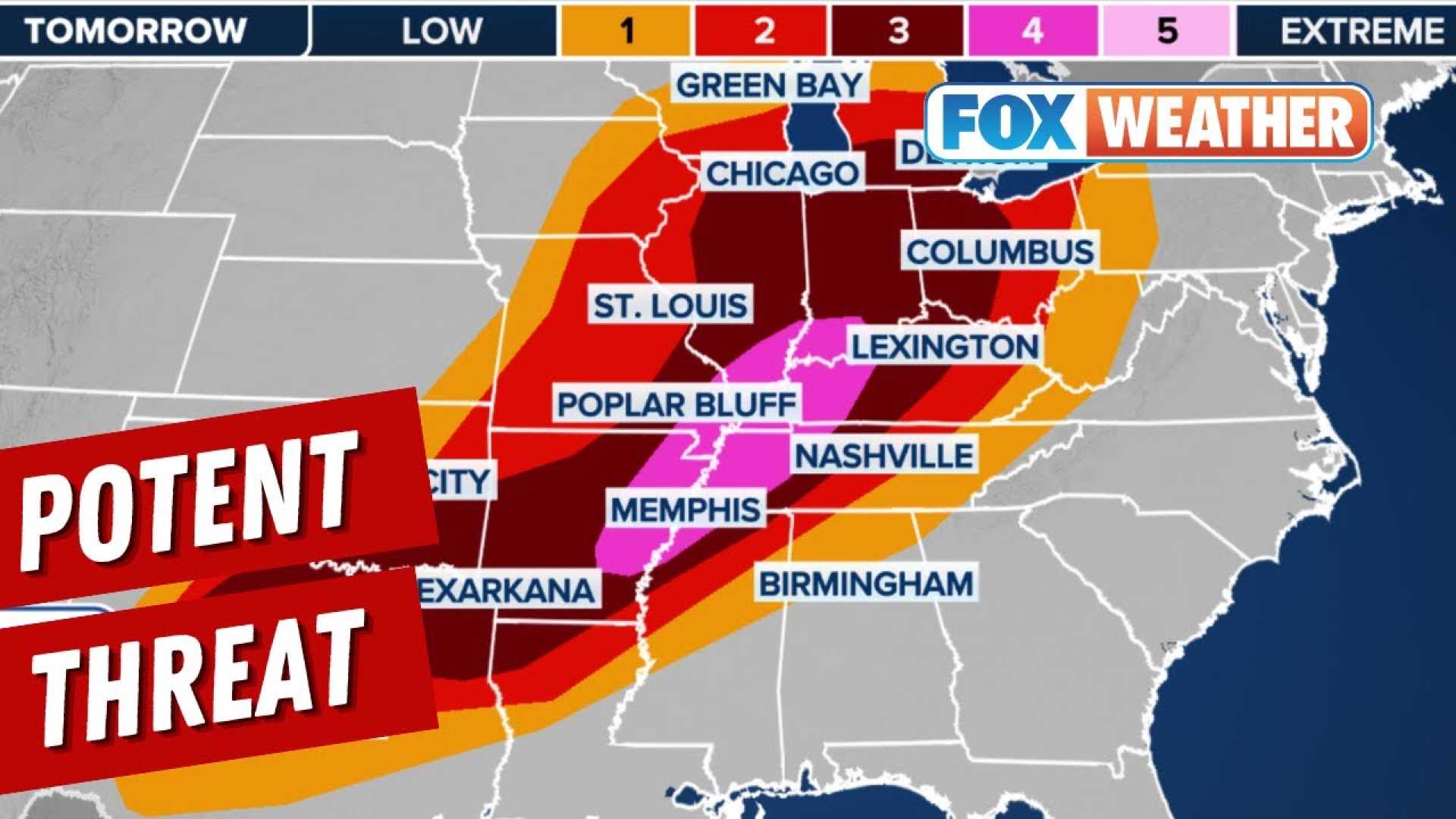
Heartland, USA – The National Weather Service has declared a First Alert Action Day due to the potential for severe thunderstorms today. Chief Meteorologist Grant Dade emphasized that while today will not mirror last Friday’s weather, significant severe storms are still a concern.
Areas within the Heartland region are categorized with a threat level of 3 out of 5 for severe storms, while others face a level 2 threat. The initial threat is expected after midnight, with a complex of storms likely to bring damaging winds and the possibility of an isolated tornado.
A severe thunderstorm watch is in effect until 8 a.m. for eastern counties. Later in the day, scattered storms are forecasted to develop ahead of a cold front by afternoon. Meteorological models show that strong thunderstorms could form, leading to possible watches and warnings.
“There are still many uncertainties about how much energy will be available for storms,” Dade stated. “However, it looks like there will be ample energy and shear to create hail, strong winds, and possibly a tornado or two.”
In addition to severe weather, flash flooding is a concern as the storms could bring 1 to 3 inches of rain. Fortunately, the storm activity is expected to diminish by early evening, ushering in a period of dry and pleasant weather.
Temperatures will cool to the mid-70s on Wednesday following the cold front passage. Although shower and storm chances will return over the Memorial Day weekend, they are predicted to remain below severe thresholds. Residents are encouraged to stay tuned for updates as the day progresses.


