News
Severe Thunderstorm Warnings in Effect Across Carolinas
CHARLOTTE, N.C. (WBTV) – Severe thunderstorm warnings have been issued across multiple counties in North and South Carolina as a powerful storm system approaches the eastern United States on Wednesday morning.
These warnings, which include Chester County where a tornado warning had previously been issued, are expected to remain in effect throughout the morning hours. With the storm system advancing eastward into the Charlotte region, meteorologists predict that the storms will strengthen and become increasingly organized.
Residents can anticipate heavy rain, damaging winds, and a potential for tornadoes as the system moves through the area. Wind gusts are forecasted to reach speeds of 40 to 50 mph, raising concerns about trees falling and possible power outages.
The severe weather is projected to mainly pass out of the Charlotte area by midday, with the most significant impacts expected by mid-morning.
WBTV meteorologist, Stephen Morgan, emphasized the importance of staying informed. “We urge everyone to monitor local alerts as conditions can change rapidly,” he stated. “It’s essential to remain prepared and vigilant during this time.”
As of 7:58 a.m., the Tornado Warning for Calhoun, Lexington, and Richland counties expired, while a Tornado Watch was issued for a broader range of counties until 1 p.m. This watch includes Chesterfield, Clarendon, Kershaw, Lancaster, Lee, and other nearby regions.
The National Weather Service highlighted that severe thunderstorms remain in effect, particularly for areas including Fairfield, Kershaw, Lancaster, and more until 8:30 a.m.
In Columbia, S.C., meteorologists issued a Weather Impact Alert, predicting that storms will begin impacting the western Midlands early Wednesday morning. The forecast indicates that the most severe conditions will occur between 5 a.m. and 1 p.m.
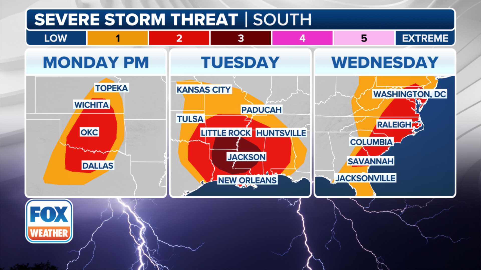
Forecast models suggest a significant risk of severe weather along the Eastern Seaboard, with over 64 million people under alert. States along the Interstate 95 corridor from Florida to Virginia are particularly affected.
Experts predict that winds may reach over 75 mph in some areas, compounding the risk of structural damage. The Storm Prediction Center has identified portions of North Carolina in a Level 3 out of 5 risk for severe weather.
“We’re expecting a classic high shear, low CAPE setup, which means there will be plenty of wind energy but potentially less fuel for the storms,” explained Marissa Torres, a meteorologist with FOX Weather. “Nonetheless, the potential for heavy downpours and damaging gusts remains high.”
Areas of concern include southeastern Virginia, central and eastern North Carolina, and coastal South Carolina, where high winds could lead to dangerous conditions.
The affected public is advised to remain alert and prepared for possible evacuations or weather-related emergencies. Monitoring local news outlets and weather stations is crucial for updates as conditions evolve.
As the morning progresses, people in the storm path should seek shelter, avoid unnecessary travel, and secure outdoor items that could become projectiles in high winds.


