News
Severe Thunderstorm Watch Issued Amid Hazy Skies This Week
ST. PAUL, Minnesota – Showers and thunderstorms moved across Minnesota Monday afternoon and evening, affecting various regions differently. While some areas remained dry, others experienced quick downpours and gusty winds. A severe thunderstorm watch was issued for areas west of the Twin Cities, lasting until 7 PM, due to potential strong winds and hail.
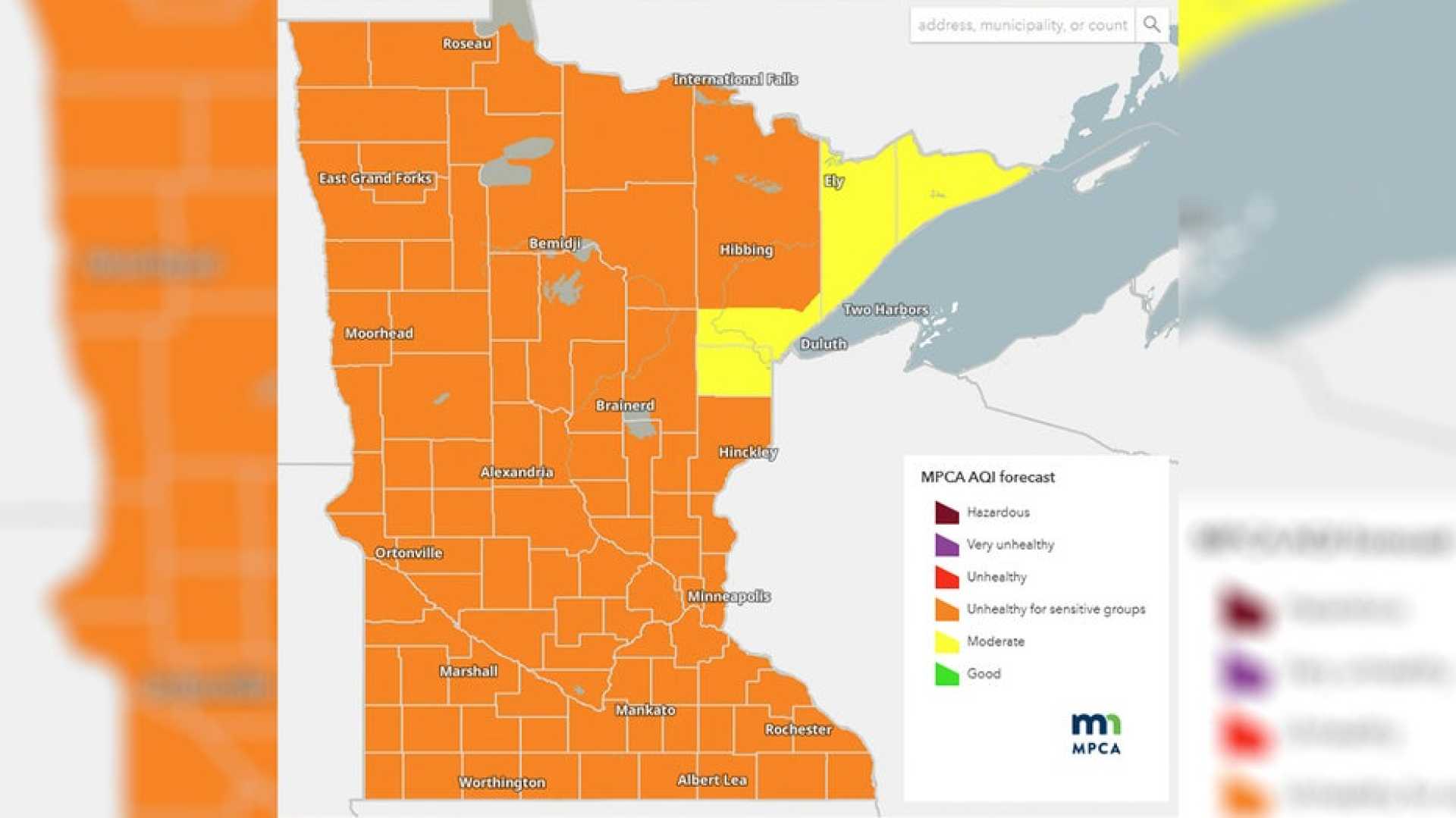
The rain is expected to continue into Tuesday, bringing cooler temperatures in the 60s and overcast skies. Meteorologist Chris Reece warns that as a cold front passes through, Canadian wildfire smoke will likely lower air quality statewide. An Air Quality Alert has been extended through Wednesday night, especially affecting those with asthma or respiratory issues.
Conditions will improve mid-week as skies start to clear on Wednesday, bringing temperatures back up into the upper 70s. The remainder of the week is anticipated to be seasonable, though additional showers and thunderstorms are predicted from Friday through Sunday. There is no indication that any of these days will be complete washouts, making it essential for outdoor enthusiasts to stay informed about weather changes.
On Thursday, after several cloudy days, sunlight returned, providing milder temperatures. The forecast for Friday predicts mostly sunny skies and temperatures climbing into the low 80s. However, by the afternoon, winds will start bringing in more wildfire smoke from Canada, making skies hazier and impacting air quality.
Saturday is expected to be the worst day for smoke throughout the state, particularly affecting areas from Fargo through Brainerd to Duluth and northwest Wisconsin. Potential air quality alerts may be issued, warning residents with respiratory conditions to limit outdoor exposure during peak smoke hours in the afternoon and evening.
Despite the smoke, Saturday’s temperatures will still reach the mid-80s, with an ongoing hot trend continuing into Sunday and Monday. After the heat, a significant chance of rain is anticipated on Tuesday afternoon, which may help alleviate both the heat and lingering smoke.
Residents are encouraged to stay aware of weather updates and monitor air quality closely as the weekend approaches, leading into a warm and hazy period.


