News
Severe Thunderstorms Expected in Michigan This Afternoon
DETROIT – Severe thunderstorms are forecast to develop today across parts of Michigan, particularly in the west-central and southwest regions of Lower Michigan. These storms are expected between 2 p.m. and 4 p.m., moving into eastern Lower Michigan by 5 p.m. to 8 p.m.
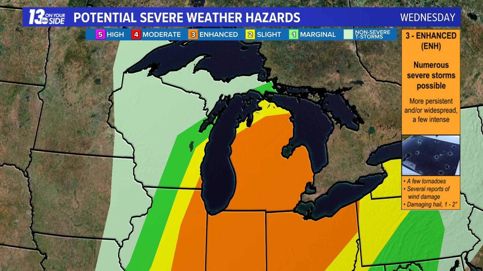
The Storm Prediction Center (SPC) has issued a level 3 risk for severe storms, indicating an Enhanced Risk for southern Lower Michigan, which includes cities like Grand Rapids, Kalamazoo, and Lansing. Surrounding this area is a level 2 risk, while the northern half of Lower Michigan faces a level 1 risk, pointing to a marginal chance of isolated lower-end severe storms.
Forecasters predict the storms will occur during the hottest part of the day when the heat and humidity peaks. The forecast also highlights a 5% chance of tornadoes in the enhanced risk zone, along with a significant 30% chance of wind gusts exceeding 70 mph.
In addition, the yellow risk area includes cities such as Grand Rapids and Flint, where there is a 5% chance for tornadoes but a lower 15% chance for damaging wind gusts. Hail up to one inch in diameter is also possible, although it is considered a lesser threat.
Residents are advised to take precautions, including parking cars in garages and avoiding outdoor activities like hiking or being on the water this afternoon. Staying close to sturdy shelter is recommended in case of severe weather.
As weather conditions can change rapidly, residents should stay informed for updates on the severe weather forecast. Overall, the expectation is for potentially hazardous weather this afternoon, culminating in significant storms throughout the state.


