News
Severe Weather Alert: Tornadoes and Flooding Threaten the Mid-South

LOUISVILLE, Ky. — Severe weather is expected to impact the Louisville region late Wednesday night, with warnings for tornadoes and heavy rain in effect. Chief Meteorologist Jay Cardosi reports that the conditions will be conducive for dangerous weather, including the possibility of multiple tornadoes and extensive flooding.
As of midday, the region is experiencing warm, humid conditions with temperatures reaching 82 degrees. However, this calm is expected to give way to severe storms that are already forming across parts of Missouri and Arkansas, prompting tornado watches in areas west of Louisville.
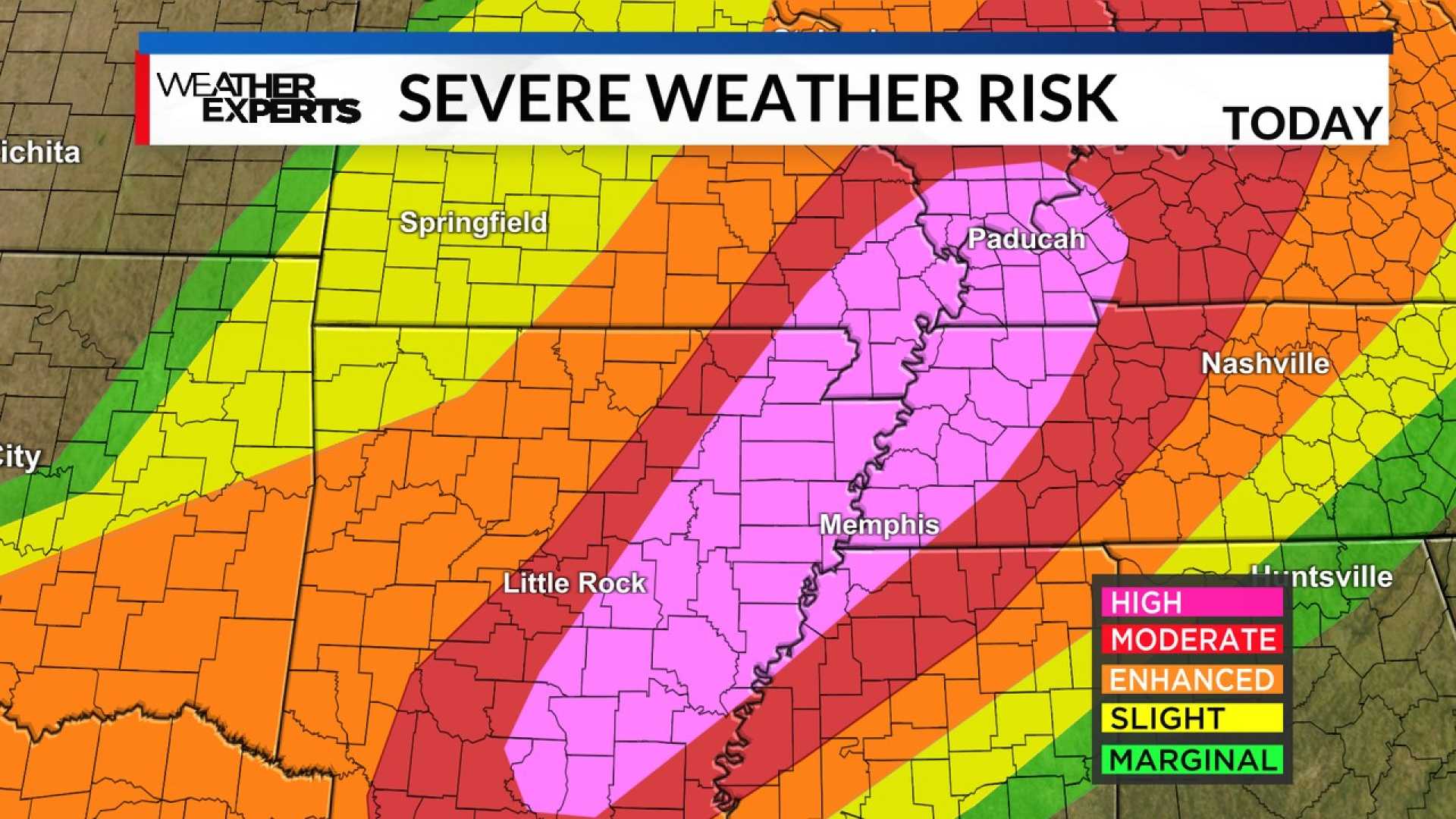
The Storm Prediction Center has issued a rare High Risk (5/5) for severe weather across parts of the Mid-South, including Memphis and eastern Arkansas. With this designation, officials warn of widespread, life-threatening weather, including long-lived tornadoes and heavy rainfall, resulting in potential flooding.
“This isn’t routine,” a spokesperson from the National Weather Service in Memphis stated in a recent announcement. “We are facing a rare, high-impact event with heavy rainfall likely leading to significant flooding, especially along and north of Interstate 40.”
Residents should be prepared for severe thunderstorms to develop between 8:00 and 9:00 PM. As storms move in from the west, early indications suggest that some may be supercellular, which can lead to tornadoes and large hail, with damaging winds also a widespread threat.
The National Weather Service has advised that areas of southern Kentucky may experience training thunderstorms, which could lead to extended periods of heavy rainfall and flash flooding. Flood watches have already been issued for significant parts of the lower Ohio Valley.
The forecast indicates that total rainfall could accumulate to between 6 to 10 inches across much of the region by the end of the week as the weather pattern stalls and oscillates, leading to multiple rounds of rain and storms.
“We have to take these storm threats seriously,” Cardosi said. “The next few days will bring multiple rounds of severe weather that may cause flooding and other hazards.”
Heavy rains are expected to continue through Sunday, with potential for damaging winds, hail, and isolated tornadoes throughout the period. Residents are urged to stay updated with local weather news and monitor for alerts regarding possible evacuations and safety measures.
As severe weather systems move across the state line from West Tennessee, reports have already indicated damage in Arkansas from earlier tornadic activity this week. It is crucial that communities remain alert and adhere to public safety guidelines as conditions develop.


