News
Severe Weather Alerts Issued as Cold Front Approaches Houston
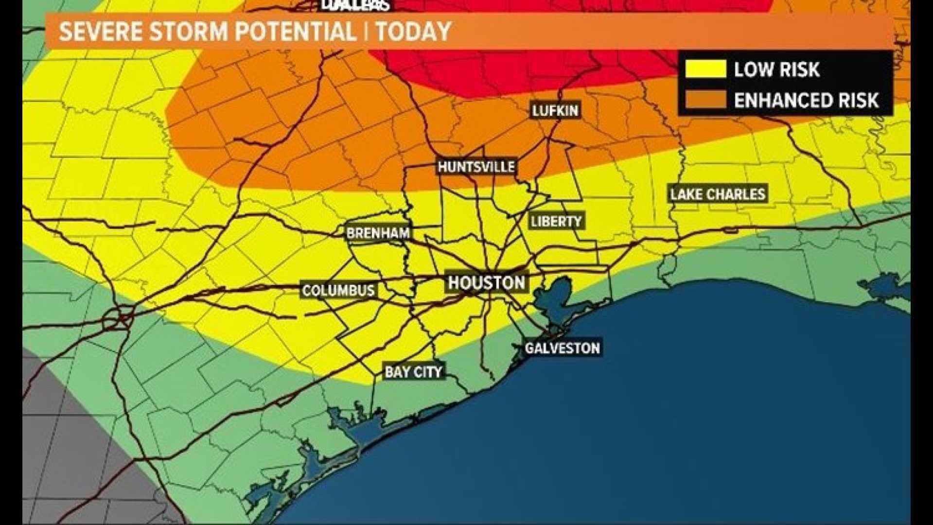
HOUSTON – A cold front stalled over north Texas is heading toward Houston later on Friday, prompting weather alerts from the National Weather Service. The Storm Prediction Center has raised the severe weather threat for Friday afternoon into Saturday morning as storms are expected to develop as the weekend begins.
According to meteorologists, Houston has experienced several days of high humidity and heat, but storm chances were limited due to a “cap” on storm development. This situation is about to change as conditions become favorable for powerful storm cells, which may produce dangerous lightning and heavy rainfall.
Storms are likely to initiate early Friday afternoon across northern counties that have previously remained dry this week. The development of sizable storm cells is expected, with wind gusts possibly exceeding 50 mph. Rainfall could reach more than an inch in a very short time, leading to flooding on local roads and streets.
The cold front is expected to sweep through the region before dawn on Saturday, with storms continuing into sunrise. Residents are urged to stay informed by checking in with the KPRC2 Weather team for updates on storm intensity and new weather data throughout the day.
Earlier this week, slow-moving thunderstorms caused significant rainfall across southern Oklahoma and northern Texas, leading to flash flooding and evacuations as people sought safety from rising waters. Reports confirmed at least three fatalities in Pennsylvania due to a powerful storm that knocked out electricity for over 425,000 customers.
Matthew Brown, the emergency services chief for Allegheny County in Pennsylvania, described the situation as a “natural disaster” with unprecedented storm damage. The severe weather has prompted multiple rescues and challenges across various affected areas.
As the severe weather system approaches, residents should remain vigilant and take precautions to ensure safety during the potentially hazardous conditions.


