News
Severe Weather Alerts Issued Across Multiple States This Weekend
COLUMBIA, S.C. (WIS) – Multiple First Alert Weather Days have been issued as a significant cold front approaches, affecting several states this weekend. Starting Sunday, areas from South Carolina to Indiana and Texas will experience heavy rain, strong winds, and potentially icy conditions.
High pressure is settling in after a cold front passed through on Saturday, bringing cooler temperatures. Today, Valentine’s Day, South Carolina will see mostly sunny skies with highs in the mid-50s, but conditions are expected to change as a warm front moves through the Midlands. The front will increase cloud cover and bring a chance of showers, with highs reaching around 60 degrees.
By Sunday, a new cold front will pass through, leading to widespread rain and intense wind gusts between 30 and 40 MPH. Forecasts indicate that rainfall could total between .25 and .5 inches, prompting the continuation of First Alert Weather Days.
“We are closely monitoring the system expected to bring wintry conditions by Wednesday,” said Chief Meteorologist Mike Slifer. “This could lead to icy road conditions, so residents should remain vigilant,” he added.
In Fort Wayne, Indiana, residents are bracing for a complex system that could bring snow, rain, and freezing rain over the weekend. Snow is expected to begin late Saturday, with initial accumulations between 1-3 inches. This could transition to rain as temperatures warm into the afternoon. However, as the temperature drops overnight, any remaining precipitation could freeze, leading to potential hazardous conditions on roads.
“The most significant impacts will occur Saturday night when we expect a shift from rain to snow, providing a total snowfall of up to 5 inches in some areas,” said WPTA Meteorologist Josh Cingranelli.
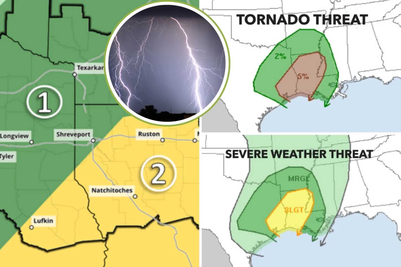
Meanwhile, East Texas is preparing for yet another round of cold air and possible winter precipitation late next week. The First Alert Weather Team forecasts temperatures to drop into the 20s, which could exacerbate wind chill factors making it feel even colder.
“At this point, it’s difficult to determine the timing and severity for winter precipitation, but we will provide updates as the forecast evolves,” said KLTV Chief Meteorologist Mike Slifer.
As communities prepare for potentially hazardous weather, meteorologists across the region are urging residents to stay informed and take necessary precautions. The upcoming days are crucial for monitoring how these weather systems develop, especially with the possibility of a more significant winter storm influencing weather patterns midweek.
Stay connected with local news outlets for continuous updates on weather alerts and forecasts.


