News
Severe Weather Brings Threats of Flash Flooding from Texas to Missouri
AUSTIN, Texas — A storm system is placing 45 million people on alert for severe weather as it moves across the central United States on Tuesday, April 29, 2025. The National Weather Service has warned that states from Texas to Missouri could experience major flash flooding.
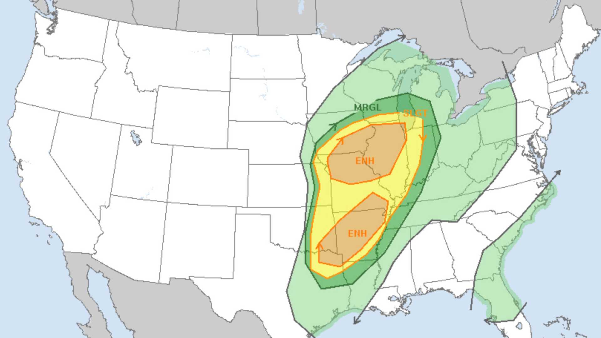
Severe thunderstorm watches are in effect from Texas to Ohio, with expectations of damaging wind gusts reaching up to 75 mph and the possibility of large hail and tornadoes. An enhanced area for severe weather extends from Louisville, Kentucky, through Cleveland and Pittsburgh to Buffalo, New York, while another area covers Texas and Oklahoma.
The greatest concern is the life-threatening flash flooding projected for Tuesday and Wednesday, particularly in Oklahoma, where forecasts predict three to seven inches of rain. This heavy rainfall adds to already saturated soil from storms that struck over the weekend.
The storms are expected to produce damaging winds, large hail, and a risk of tornadoes from Waco, Texas, to Dallas and Little Rock, Arkansas. Significant rainfall is expected to lead to further flash flooding across the Texas-Oklahoma Red River Valley and into the Ozarks by Wednesday.
A Level 3 out of 4 flash flooding threat has been issued for parts of Texas, Oklahoma, and southwestern Missouri as excessive rainfall is anticipated Tuesday night.
On Monday night, the central U.S. faced severe storms that included heavy rain and hail. In Kansas, FOX Weather Storm Chaser Mark Sudduth reported being caught in a severe hailstorm while tracking storms in the area. No major tornadoes were reported, but the thunderstorms resulted in widespread strong winds and dangerous hail.
This storm is part of an active spring weather pattern that has already led to significant weather disruptions across the central and southern U.S. As meteorologists continue to monitor the situation, citizens are advised to stay informed and prepare for potential evacuations in flood-prone areas.


