News
Severe Weather Expected as Easter Weekend Approaches
LOUISVILLE, Ky. — As Easter weekend approaches, residents in Kentuckiana should prepare for an active weather pattern bringing potential severe storms and heavy rainfall.
The National Weather Service (NWS) forecasts light rain showers possible Thursday afternoon, but much of the moisture may be mitigated by dry air at the surface. Friday’s weather is expected to be warm, with temperatures reaching the upper 70s to low 80s, accompanied by gusty southerly winds.
A cold front is expected to approach from the west Friday night, increasing the chances of scattered showers and storms, particularly for southern Indiana counties. A few strong storms may develop north of Louisville late Friday night into early Saturday morning.
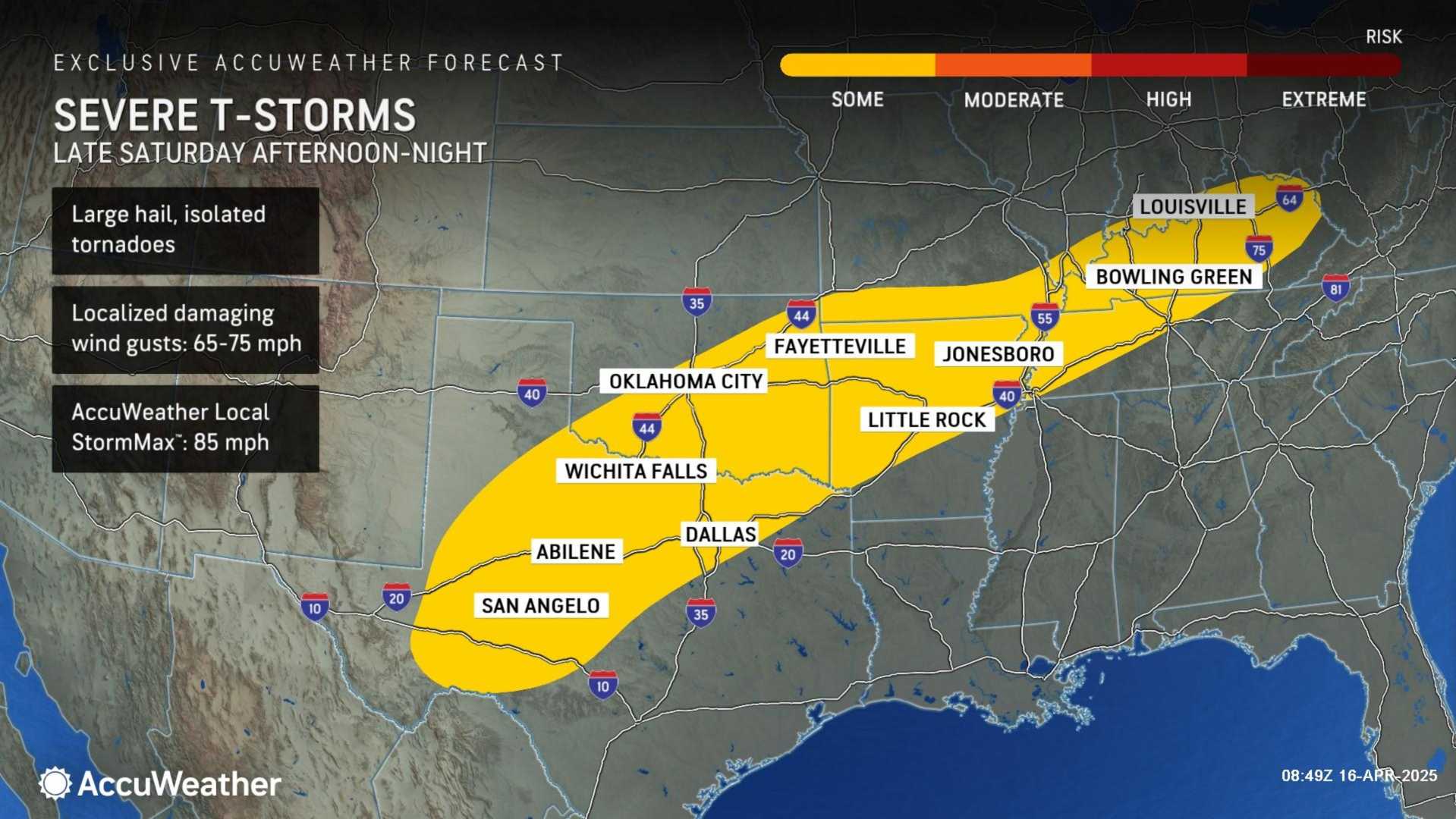
As the front progresses, waves of showers and thunderstorms could continue into Saturday.The precise location of the front will determine where the heaviest rainfall occurs and where strong to severe thunderstorm warnings may be issued. Meteorologists anticipate sufficient heat and humidity in the afternoon and evening hours to support storm development.
Weather models are showing divergence for Sunday. The European model suggests a more northerly path for the low-pressure system, which could keep much of Kentuckiana dry throughout the day before the cold front passes through Sunday night. In contrast, the American model indicates a southerly track, maintaining the potential for showers and storms through Sunday.
Regardless, both models suggest a risk of severe thunderstorms arriving in the early hours of Monday morning, with estimates of strong winds and possibly nickel-sized hail as storms pass through.
In total, Kentuckiana could see rainfall amounts ranging from 0.25 to 2 inches, depending on the storm tracks, with southern Indiana likely anticipating the heaviest precipitation.
Amid these weather concerns, over 28 million people across the Ohio Valley and central Appalachians will also face risks for severe weather as the holiday approaches. Kendall Smith, a meteorologist at FOX Weather, reported that cities such as Indianapolis and Louisville are included in a Level 2 risk zone for severe weather, with concerns for damaging winds and large hail.
As preparations for Easter festivities proceed, including brunches and egg hunts, residents are urged to stay updated on weather developments. NWS officials advise that weather conditions may change rapidly, underscoring the importance of monitoring forecasts leading up to and throughout the weekend.


