News
Severe Weather Forecast: Thunderstorms and Strong Winds Ahead
DETROIT, Mich. – Meteorologists forecast a significant weather shift in Southeast Michigan with temperatures soaring near 70 degrees in the coming days, followed by thunderstorms and possible strong winds.
Today and tomorrow are anticipated to be the warmest days of the week, with highs reaching either side of 70 degrees. According to local meteorologists, gusts may hit up to 20 mph, and there’s a chance of non-severe thunderstorms developing tonight into tomorrow morning.
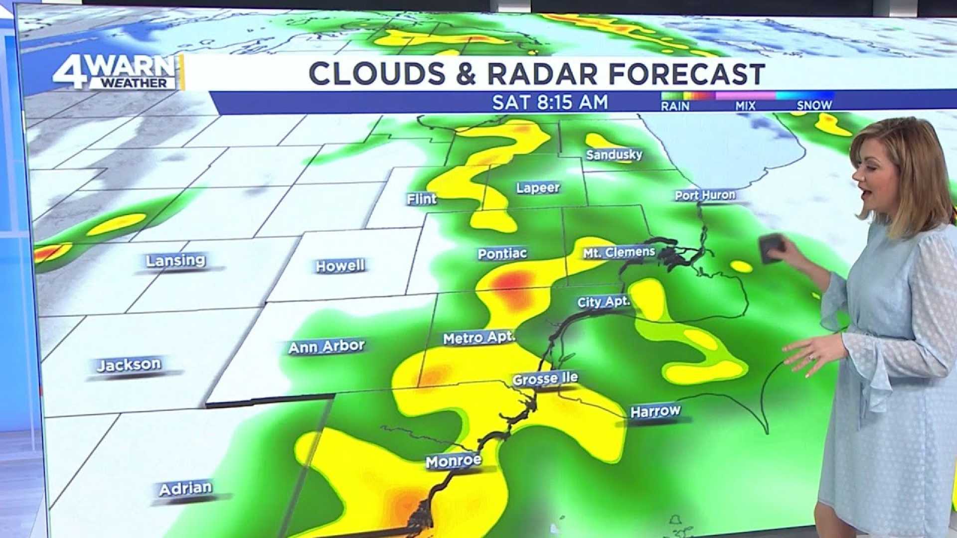
“We expect the rain to clear by late Saturday morning, but the wind will pick up, possibly exceeding 40 mph,” said Ashlee Baracy, an Emmy award-winning meteorologist with WDIV. “Our viewers should be prepared for another round of thunderstorms late Saturday and into Saturday night, which could be strong in nature.”
Saturday’s thunderstorms are projected to bring heavy rain, just before temperatures start to fall into the 50s on Sunday. The overnight drop will likely see lows fall back into the 20s by Monday morning.
As the week progresses, forecasters predict that St. Patrick’s Day will see a high around 50 degrees. However, temperatures are expected to rise again, reaching the 60s on Tuesday and Wednesday, before another cool front arrives on Thursday. This change could bring rain transitioning to snow just as spring officially begins.
As for Friday, the forecast remains mostly dry, with warmer temperatures allowing for highs in the mid to upper 60s. Southeast winds will range between 5 to 15 mph, contributing to the pleasant conditions.
“It’s important to stay updated as we move into a weekend with unpredictable weather conditions. Plan your outdoor activities accordingly and keep an eye on our updates for more detailed weather information,” Baracy advised.
For the latest and detailed daily forecasts, viewers are encouraged to tune into 4Warn Weather on weekday mornings and at noon, along with streaming updates on Local4+.


