News
Severe Weather Risks Loom Over the Mid-South Today
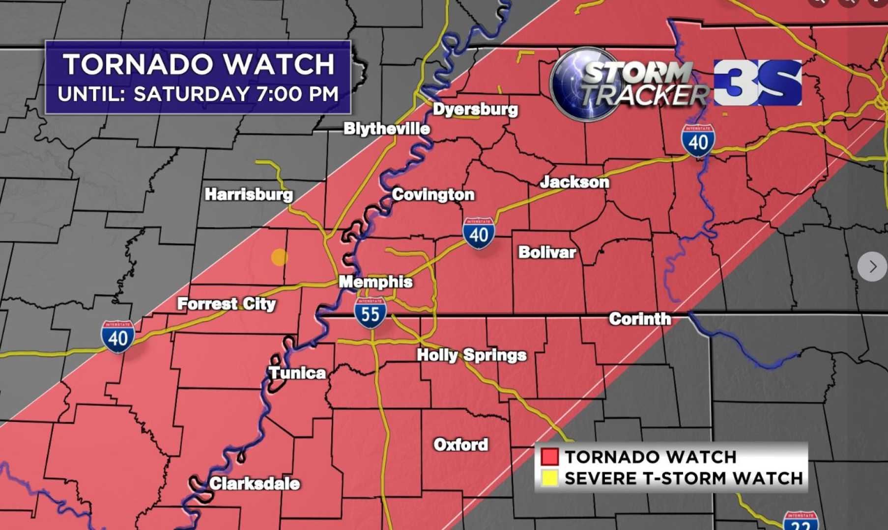
MEMPHIS, Tenn. – A Tornado Watch has been issued for Tennessee, Mississippi, Arkansas, Louisiana, and Texas until 10 p.m. CST, as announced by the National Weather Service.
The watch includes major cities such as Memphis, Oxford, Miss., and Jackson, Tenn. Residents are warned of potential threats, including tornadoes, hail, and wind gusts up to 70 mph.
In addition to the tornado threat, a Flood Watch is in effect for Memphis and the Mid-South area, expected to last until early Sunday morning. The flooding risk is primarily concentrated in West Tennessee and northeast Arkansas, including the Missouri Bootheel.
Storm systems are projected to develop over Arkansas and move towards the Mississippi River by 6 p.m. CST, with conditions that have already propelled temperatures to around 70 degrees due to a warm front. This warmth may serve as fuel for strong storms ahead of a primary line of severe weather expected to form by late afternoon or early evening.
“The timeline for these storms is primarily between 5 p.m. and 9 p.m.,” said a meteorologist at the National Weather Service. “The main threat will be damaging winds and the potential for tornadoes.” Following the frontal passage, temperatures are expected to plummet with gusty northwest winds.
Saturday’s forecast indicates widespread showers and strong thunderstorms, with expected highs near 70 degrees. Winds will be from the south at 10-15 mph, gusting up to 30 mph. Severe weather is particularly likely along and south of Interstate 40, raising concerns about tornadoes rated EF-2 or stronger, as well as heavy rainfall.
Heavy rains, predicted to result in totals of 4-6 inches, could lead to flash flooding in northwest Tennessee. Meteorologists warn residents to remain alert, as storms may develop quickly across the region.
As the evening progresses, thunderstorms and heavy rain will continue before tapering off overnight. Temperatures are forecast to drop to around 35 degrees, accompanied by breezy southwest winds at 15 to 20 mph.
Forecasts for Sunday predict cloudy skies that will gradually clear, with much colder conditions leading to a high near 41 degrees. Winds are expected to shift to the northwest at 10-20 mph, with gusts approaching 30 mph, leading to a chilly night with lows around 25 degrees.
Looking ahead, Presidents Day features partly cloudy skies with temperatures around 43 degrees. By Tuesday, there’s a 30 percent chance of rain and snow, with significant accumulation in the evening hours.
Travelers should keep abreast of weather advisories as arctic air moves into the region, potentially triggering dangerous wind chills and record-breaking cold temperatures early next week.
To stay updated on severe weather alerts, download the FOX13 Memphis app for timely notifications.


