News
Severe Weather Threat Looms Over Louisville This Weekend
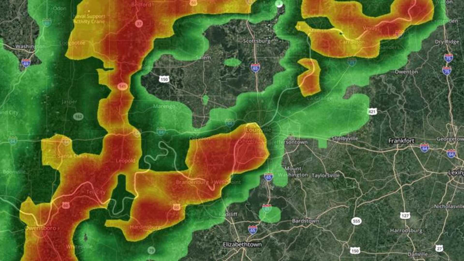
LOUISVILLE, Ky. — A severe weather system is expected to impact parts of Kentucky overnight Friday and into Saturday morning, raising concerns about possible tornadoes and severe thunderstorms, according to the WHAS11 Weather Impact Team.
The team has issued a Weather Impact Alert for Saturday, as strong-to-severe thunderstorms are anticipated throughout the afternoon and evening. The most significant threat to the region will develop in the afternoon, with a potential for damaging winds and heavy rainfall.
While the line of storms approaching Louisville is expected to weaken, areas west of I-65 could still experience gusty winds and heavy rain before sunrise. Meteorologists have indicated that regions south of Kentucky, specifically Alabama and Mississippi, are at a higher risk for tornado outbreaks.
The Storm Prediction Center has classified the potential for severe weather as a level 4 out of 5 for Friday, with an alarming forecast of upgraded risk to level 5 for Saturday, which is relatively rare and indicates the possibility of strong tornadoes and damaging winds.
As storms continue through the night, numerous tornadoes have already touched down in the mid-South and Midwest, with substantial damage reported near St. Louis. Forecasts suggest thunderstorms could stretch from the Great Lakes to the Tennessee Valley and Deep South by dawn.
The primary threats associated with these storms include damaging winds, large hail—potentially the size of baseballs—and flash flooding. Various areas, including parts of Alabama, Georgia, Louisiana, Mississippi, Tennessee, and the Florida Panhandle, are at heightened risk.
Specifically, eastern Mississippi and western-central Alabama have been highlighted as the most at risk for tornadic supercell thunderstorms. Residents in these areas are advised to seek shelter from the afternoon through the evening, as severe conditions may linger overnight.
In Louisville, weather conditions are anticipated to worsen Saturday afternoon. Winds could exceed 40 mph, necessitating a Wind Advisory in effect until 8 p.m. Additionally, a Flood Watch has been issued for areas along and south of the Bluegrass Parkway, with potential rainfall accumulation of 3-4 inches, leading to flash flooding.
The WHAS11 Weather Impact Team encourages residents to stay informed during these severe weather events, advising to charge cell phones and keep a weather radio and first aid kit on hand. Those seeking safe shelter from tornadoes should find a sturdy structure away from windows, avoiding mobile homes.
For updated weather warnings and alerts, residents can download the free WHAS11 app, which offers live coverage and real-time notifications, ensuring they stay prepared as severe weather unfolds this weekend.


