News
Severe Weather Threat Looms Over South Carolina Overnight
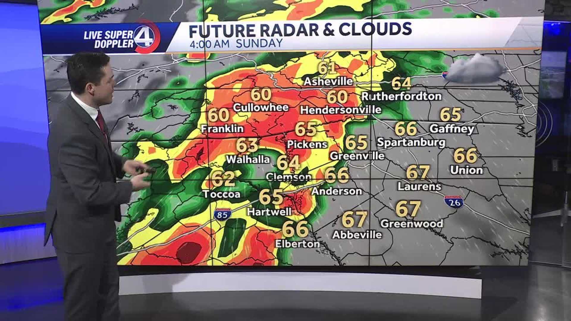
GREENVILLE, S.C. — Severe weather, including the risk of strong tornadoes, threatens South Carolina‘s Upstate early Sunday morning as a powerful cold front approaches the region.
The National Weather Service has issued tornado watches as multiple thunderstorms are expected to roll through the area between 2 a.m. and 8 a.m. local time on March 16. These storms may produce damaging winds up to 70 mph, large hail, and possibly a few tornadoes.
According to a meteorologist from WYFF, a line of severe thunderstorms is forecast to enter Northeastern Georgia and Western North Carolina around midnight, advancing towards the Upstate. The storms are anticipated to progress eastward, reaching areas such as Greenville and Anderson by the early morning hours.
“We need to be prepared. The latest models suggest the storms will arrive in phases, and while we could see severe storms tonight, calmer weather will return by morning,” the meteorologist stated.
In the Upstate, temperatures are currently in the upper 60s, providing ample instability for storm development. The line of storms is expected to pass through with the most severe weather likely to hit around 2 a.m. Once the storms have cleared the region by 9 a.m., mostly sunny conditions are forecasted for the rest of the day with highs in the low to mid-70s.
Residents are advised to remain vigilant during the storm and have a plan in place for severe weather. “Make sure you have a way to receive notifications, and be ready to take shelter if necessary,” officials said.
The weather system will strengthen overnight, with wind gusts of 40 to 50 mph reported ahead of the storms. Even after the storms pass, lingering winds may cause additional concerns.
As the severe weather targets the Upstate, the risk will gradually shift eastward towards the Midlands and the coastal areas by late morning. No flooding is expected, but isolated heavy rainfall exceeding one inch could occur in some parts.
“This is a serious situation, and we recommend that people have their weather apps ready for timely alerts. Staying informed is key during these types of weather events,” the expert added.
St. Patrick’s Day is expected to bring cooler, drier conditions with temperatures dropping into the 40s overnight. Monday’s forecast shows high temperatures in the 60s, with mostly sunny skies returning for the week.
Residents can track the weather via local news channels or their smartphone applications to remain updated on any changes in the forecast and severe weather alerts.


