News
Severe Weather Threat Looms Over Metro Detroit This Week
DETROIT, Mich. – Severe weather, including thunderstorms and a potential tornado, is forecasted to impact Metro Detroit on Wednesday evening and night. The 4Warn Weather team is actively monitoring the situation and will provide live updates throughout the day, given the urgency of the situation.
The storms that passed through earlier this afternoon have paved the way for expected severe weather later tonight. A Severe Thunderstorm Watch has been issued for parts of Southeast Michigan until 10 p.m. This watch signifies that conditions are favorable for thunderstorms capable of producing damaging winds of 58 mph or greater and quarter-sized hail.
According to the National Weather Service, a severe thunderstorm warning may follow if the storms exhibit capabilities of generating dangerously high winds or large hail. Residents are urged to take shelter immediately during severe storms, as tornadoes can develop rapidly from such weather systems.
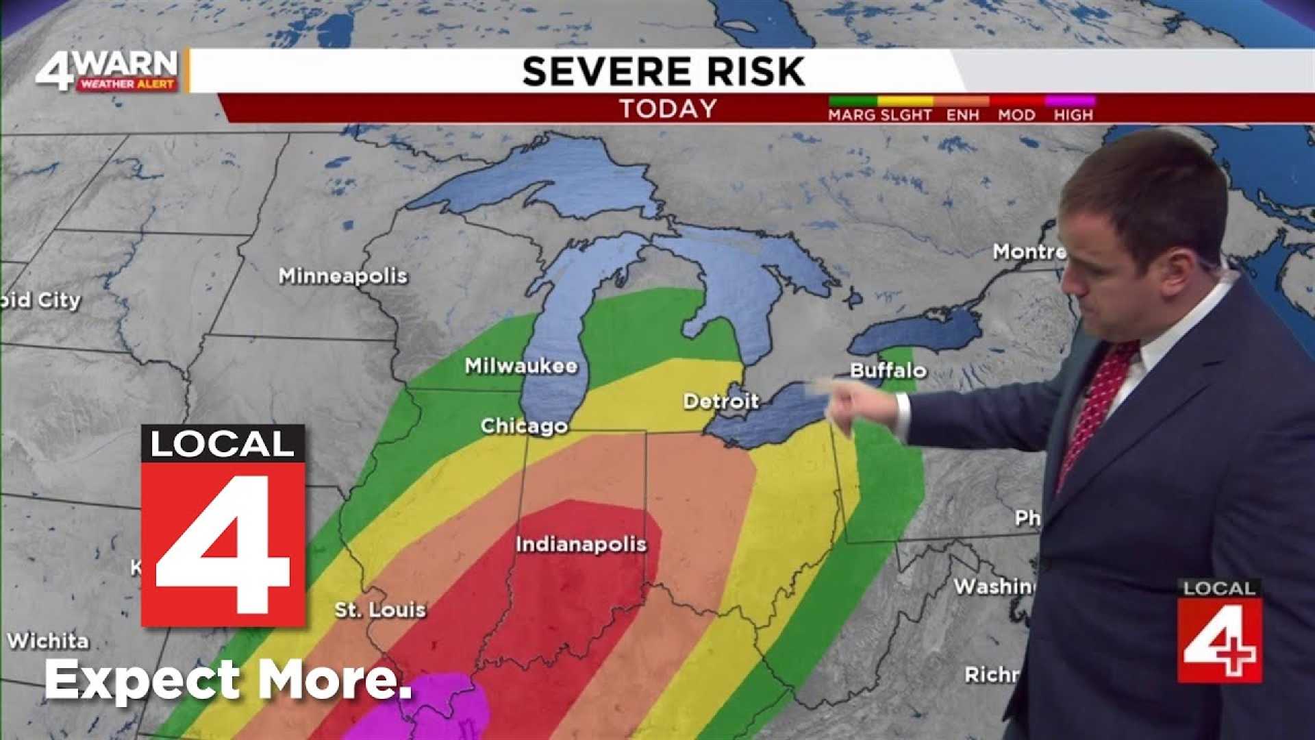
A tornado warning indicates that a tornado has either been sighted or indicated by radar, signaling imminent danger. Storm Prediction Center officials have rated the risk of severe thunderstorms for Southeast Michigan at an enhanced (level 3 of 5). This heightened risk suggests a high confidence of scattered to numerous severe storms producing damaging winds, severe hail, and even tornadoes.
Local meteorologists are advising residents to seek shelter in the basement or lowest level of a home during storms. If a basement is unavailable, an interior room or closet is recommended. Avoiding windows is key to safety. If sufficient time exists before the storm arrives, moving to a sturdy building is advised. Those unable to reach a shelter in time should lie flat in a ditch, covering their heads for protection.
The severe weather threat is anticipated to diminish by 10 p.m. However, rain and thunderstorms are still possible afterward. Following the cold front, temperatures are expected to drop into the 50s overnight, continuing to decline on Thursday.
Ron, a member of the 4Warn Weather Team, emphasizes the importance of having multiple channels for weather alerts, including a NOAA Weather Radio and the 4Warn Weather app for real-time updates.
In addition to thunderstorms, possible flooding is a concern. Residents are reminded to check sump pumps and move valuables out of basement areas ahead of Wednesday’s precipitation. Rain is expected to begin post-midnight on Tuesday and may mix with snow in northern suburbs, particularly around Midland-Saginaw Bay, where a winter weather advisory will be in effect.
As the severe weather approaches, officials urge community members to stay vigilant and heed safety precautions. For continuous updates, tuning into Local 4 and using the 4Warn Weather app is advised.


