News
Severe Weather Threat Looms Over Midwest as Tornadoes Strike
MINNEAPOLIS, Minnesota — Severe weather is forecasted to impact the Midwest and Plains starting Monday night and continuing through Wednesday. The FOX Forecast Center warns of multiple rounds of intense thunderstorms capable of producing large hail, damaging wind, and tornadoes across the region.
FOX Weather Meteorologist Kiyana Lewis said, “It’s going to be busy. We have today’s problems, then we have Tuesday and Wednesday lined up, all with very similar potentials for every mode of severe weather.” This sustained severe weather pattern poses risks to tens of millions of people.
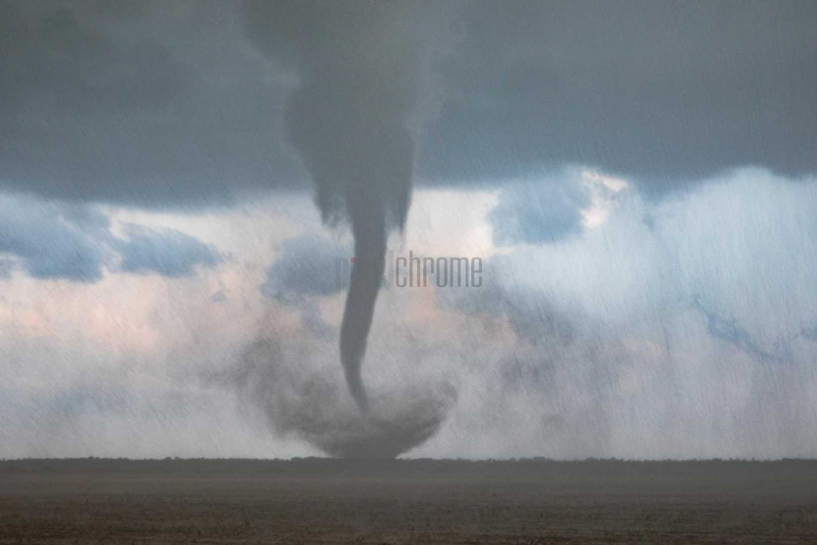
Early Monday, severe thunderstorms caused strong winds in the Dakotas and were expected to move east toward northern Minnesota. Wind gusts reached up to 81 mph in Great Falls, Montana, on Sunday night. By evening, a tornado was confirmed near Nisswa and Gull Lake, Minnesota, moving east at 4:45 p.m. as reported by the National Weather Service.
Lake Shore’s FOX Weather Storm Tracker Corey Gerken captured the tornado on video. A Tornado Watch has been issued for parts of Minnesota, including the Minneapolis–St. Paul area, as forecasters anticipate more storms to develop and raise the risk of tornadoes.
The FOX Forecast Center reported that severe thunderstorms are forming along a front across the Upper Midwest, where warm, moist air is making conditions unstable. Central and southern Minnesota are likely to experience the most intense storms, with potential for large hail and damaging winds.
A Level 3 out of 5 weather alert is in effect for central Kansas due to the highest tornado potential. Meteorologists caution that the slow-moving storms, alongside heavy rains, might lead to flash flooding. The region could see 2-3 inches of rain, exacerbating existing flooding issues.
The severe weather threat will continue migrating eastward into places like Iowa, Missouri, and Illinois as the week progresses. The intensity of the storms is expected to decrease by Wednesday, but areas like St. Louis, Memphis, and Little Rock remain under threat.
The current unsettled weather pattern is notable, as it is atypical for this time of year. As the severe weather unfolds, meteorologists urge residents to stay updated on local forecasts and be prepared for dangerous storm conditions.
According to NOAA, June and July usually witness the highest rates of severe weather in the northern Plains and Upper Midwest. Forecasters predict more than 200 tornadoes typically occur in the region in June, bringing with them risks of damaging winds and flash floods.


