News
Severe Weather Threat Looms Over Charlotte Amid Tornado Warnings
CHARLOTTE, N.C. (WBTV) – Severe weather is set to impact the Charlotte area Wednesday morning, bringing heavy rain, powerful storms, and the potential for tornadoes. A tornado warning is currently in place for Union County until 9 a.m., following an earlier warning for Chester County that expired at 7:45 a.m.
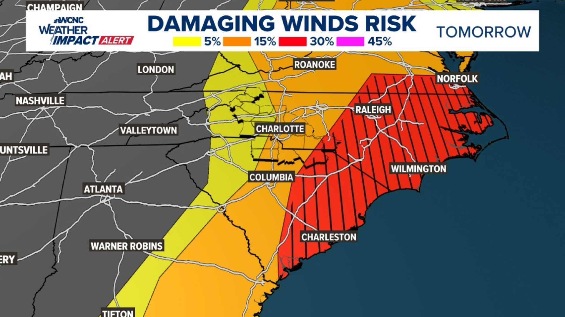
As a strong cold front moves through the Carolinas, a line of organized storms is anticipated to become more severe as it approaches the Charlotte region. Meteorologists warn that the risk for damaging winds and tornado activity will escalate through the morning, particularly in the eastern Carolinas.
“The conditions are conducive for severe thunderstorms,” said local meteorologist Eric Thomas. “We’re expecting heavy rainfall, winds gusting between 40 and 50 mph, and an increased chance of tornadoes.”
Residents can expect the most intense weather impacts to occur by mid-morning. The National Weather Service advises that these storms may cause downed trees and isolated power outages across the area.
“Prepare for thunderstorms, and stay tuned for updates,” Thomas added. “Storms are anticipated to clear out of the area by midday, but we cannot rule out lingering thunderstorms into the afternoon.”
In response to the weather system, several school districts throughout North and South Carolina have modified their schedules for the day. The complete list of school schedule changes is available on local district websites.
Looking ahead, after Wednesday’s severe weather, temperatures are expected to drop into the 30s tonight, with a brief warming trend returning on Saturday before more rain chances arise on Sunday.
Residents are encouraged to download the WBTV mobile app to receive timely weather alerts and forecasts, ensuring they stay informed during this severe weather event.


