News
Severe Weather Threat Low as Rain Moves Through Indianapolis
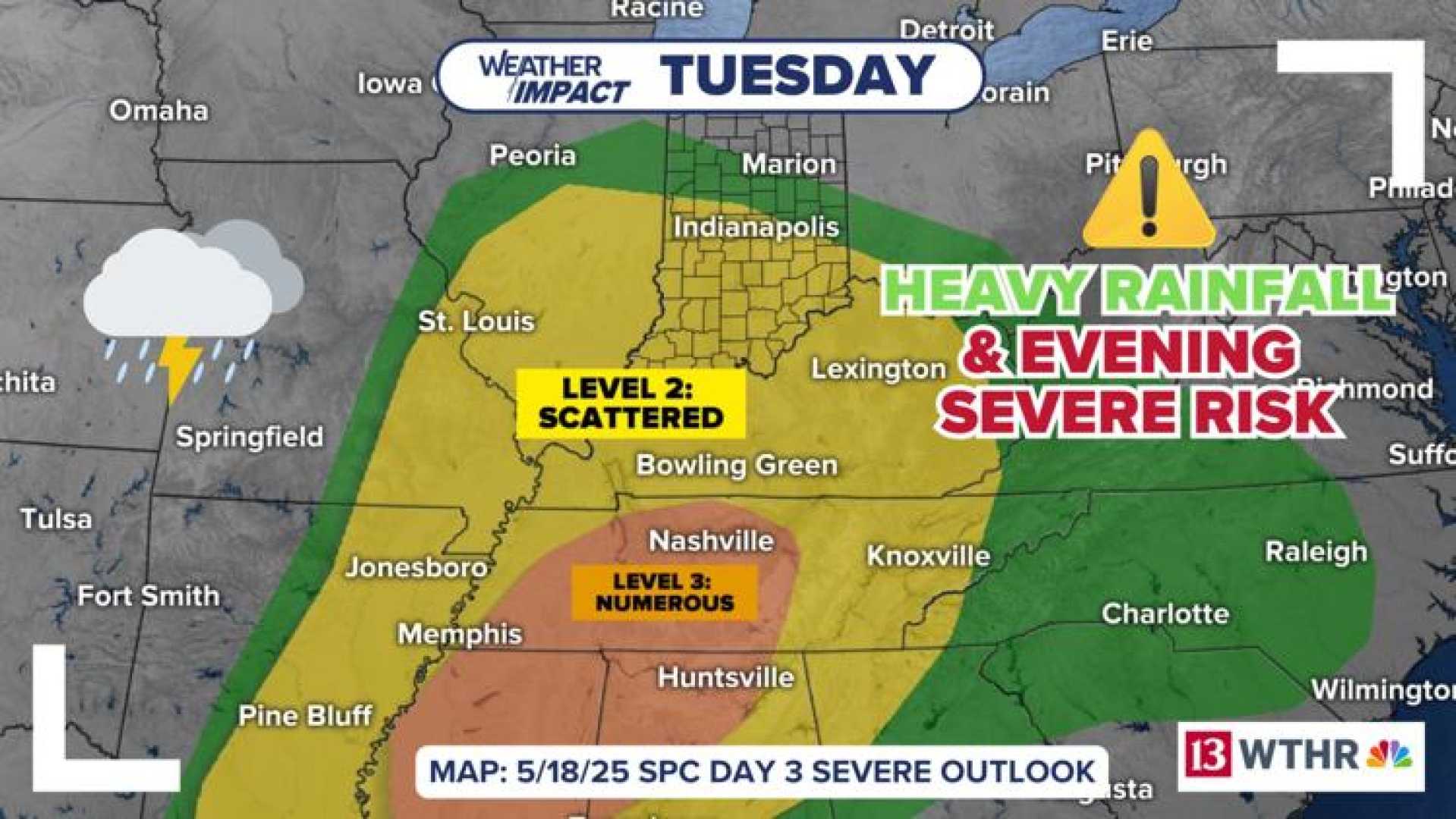
INDIANAPOLIS — Heavy rain and storms are forecasted to sweep through Indiana, but the threat of severe weather remains low. The rain will continue to move east across the state as a weather system pushes through.
Wednesday marks a transition to cooler temperatures, with highs expected to reach only the mid-60s. This chill will persist into Thursday, where even afternoon temperatures may struggle to reach the 60-degree mark amid lingering showers.
Temperatures will be particularly brisk for Carb Day, with morning lows dipping into the low to mid-40s. The afternoon will bring a slight warming trend, reaching the mid-60s with partly cloudy skies.
Race weekend is expected to bring continued below-average temperatures, likely remaining in the 60s. While Saturday appears dry, a developing low-pressure system could threaten rain in areas just southwest of Indiana on Sunday. Meteorologists advise keeping an eye on the forecast as updates for Race Day are anticipated.
In contrast, the Mid-South is experiencing calmer weather this morning, with mostly clear skies and temperatures rising to the low 80s by afternoon. Rain chances remain low until late Wednesday night, although overnight storms may pose a wind and hail threat, classified as a Level 1 on a 5-point scale.
As the week progresses, more typical spring-like temperatures in the upper 80s are expected, with an increasing chance of scattered showers and thunderstorms over the weekend.


