News
Severe Weather Threats Loom Over Midwest and Plains States
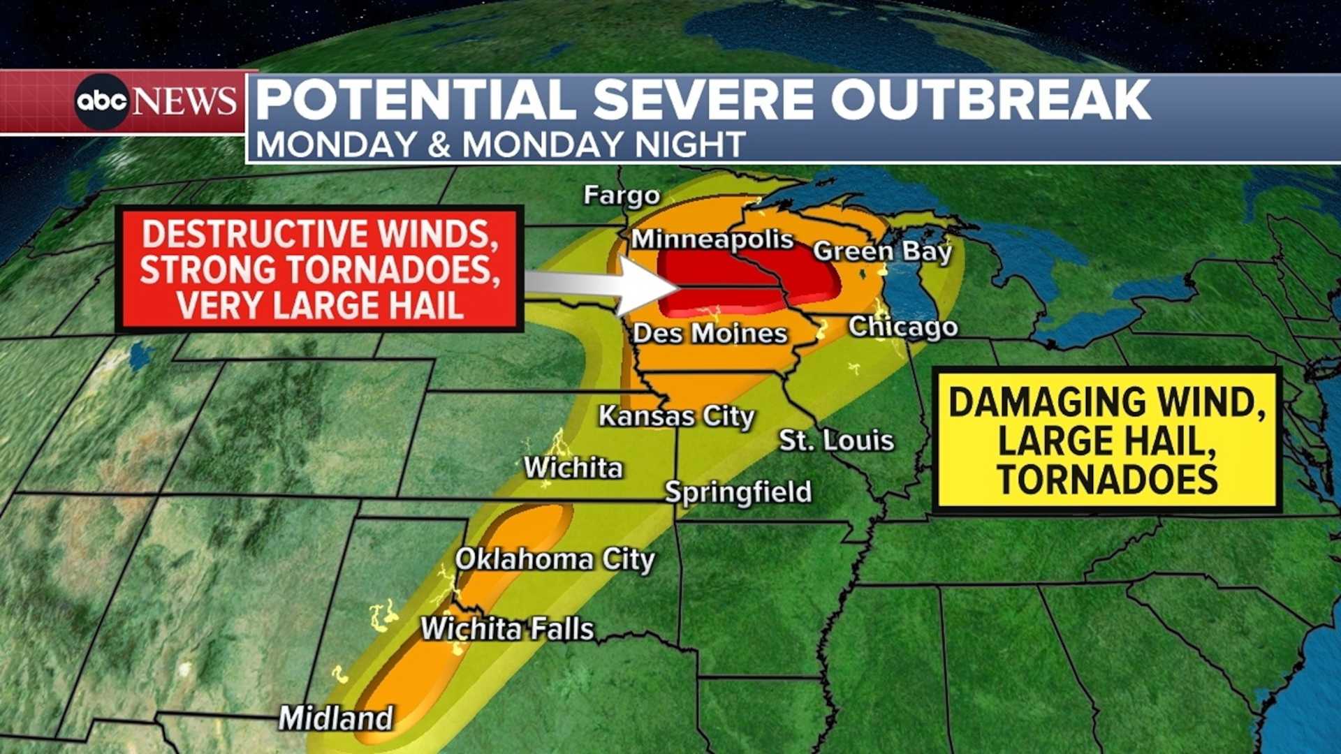
CHICAGO, IL — A large area of the Midwest and Plains states is now under a tornado watch as severe weather conditions are expected to last into next week, according to the National Weather Service. On Thursday, forecasters warned that dangerous storms could produce large hail and damaging winds across the region.
As threatening weather approached Soldier Field, organizers postponed the start of a concert featuring a popular pop star. A tornado watch is active for 17 counties in Illinois. This weather system has already resulted in tornadoes touching down in Wisconsin and Minnesota, causing damage to homes and agricultural structures.
Officials in downtown Minneapolis issued a tornado warning as a dark cloud formation moved through the area. The storm system is moving from west to east, posing a significant threat to cities including Nashville and the broader Tennessee region.
The Chicago metro area, along with northwest Indiana, will remain under a tornado watch until 10 p.m. CDT. A severe thunderstorm warning has also been issued for a larger portion of the region. Residents should brace for conditions that could generate hail the size of golf balls and winds reaching 75 mph, which may down trees and cause power outages.
The National Weather Service has noted that the severe weather risk extends to the borders of Arkansas, Louisiana, and Texas. Widespread showers and thunderstorms are expected to develop across the Kentuckiana region, with the possibility of strong winds and heavy rains.
Later into the evening, rainfall could reach rates of 1 inch per hour, raising concerns for possible flooding. Meteorologists advise that conditions should improve by early Wednesday morning, offering a brief respite from the severe weather.
This is a developing story, and updates will be provided as more information becomes available.


