News
Severe Weather Threats Loom Over Houston and Surrounding Areas
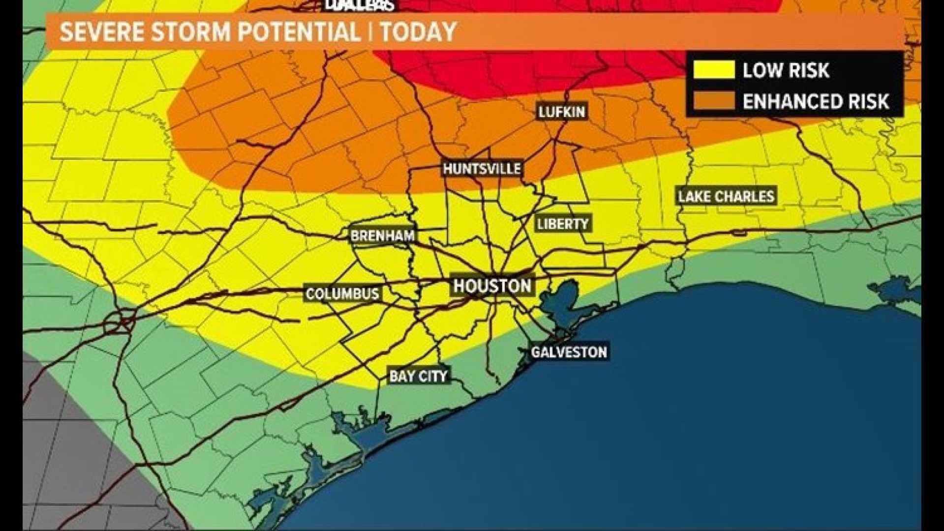
HOUSTON – Severe weather is expected to impact the Houston area on Tuesday, with heavy rain and strong storms predicted. The National Weather Service (NWS) has issued a Flood Watch for several counties, including Grimes, Walker, Polk, San Jacinto, and Trinity, effective from 7 a.m. Tuesday.
On Monday, the weather started clear and cool, but clouds are expected to roll in later in the day, leading to late-afternoon rain showers and high temperatures near 80 degrees. The NWS indicates that some areas north of Houston could receive up to 4 inches of rain, while surrounding suburbs might see patchy amounts of 3 inches.
Mike Iscovitz, a meteorologist, emphasizes that the storms could carry risks such as heavy rainfall, possible hail, and high winds. He noted that pockets of heavy rain could also affect Houston itself, even if the flood watch does not extend to the city just yet.
Tuesday is designated as a FOX 26 Storm Alert Day, meaning residents should prepare for potentially severe weather conditions. The heaviest storms are expected to occur in the afternoon and evening hours, with lingering rain probable on Wednesday.
In addition, a Thunderstorm Watch is in effect until 8 p.m. Friday for Harris, Fort Bend, Montgomery, and other surrounding counties. Recent forecasts suggest that Friday’s highs will reach the mid-80s, but severe weather alerts have since been canceled.
As storms are anticipated to linger through Saturday, the weekend outlook appears promising with milder temperatures ranging from the 50s to 80s.


