News
Severe Weather Warnings Extended in St. Louis Through Thursday
ST. LOUIS — Waves of showers and thunderstorms are expected in the St. Louis region through Thursday, prompting an extension of Weather Impact Alerts. While the overall threat of severe weather remains limited, local meteorologists caution that some storms could be strong, producing hail and gusty winds.
Rainfall has already been significant in St. Louis, with 9.85 inches recorded so far this April. This total exceeds the fourth wettest April on record, surpassing 1944’s 9.54 inches. With additional rain forecasted, local officials are preparing for potential runoff and flooding due to saturated ground.
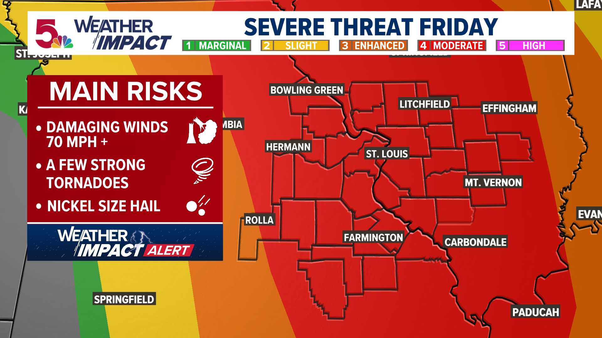
The Storm Prediction Center has highlighted a “slight” risk for severe weather, indicating the possibility of brief, weak tornadoes later today. Meteorologists noted that the combination of a warm front moving north and existing storm systems may increase the likelihood of developing rotating storms between 1 PM and 7 PM.
As the day progresses, residents are urged to stay vigilant. The 5 On Your Side Weather Impact team reports that the tornado threat has intensified this morning, with conditions being closely monitored.
In addition to tornadic activity, the forecast expects scattered thunderstorms. Local meteorologists recommend that residents remain prepared for changing weather throughout the afternoon and evening.


