News
Severe Wind and Red Flag Warnings Hit Colorado Springs This Week
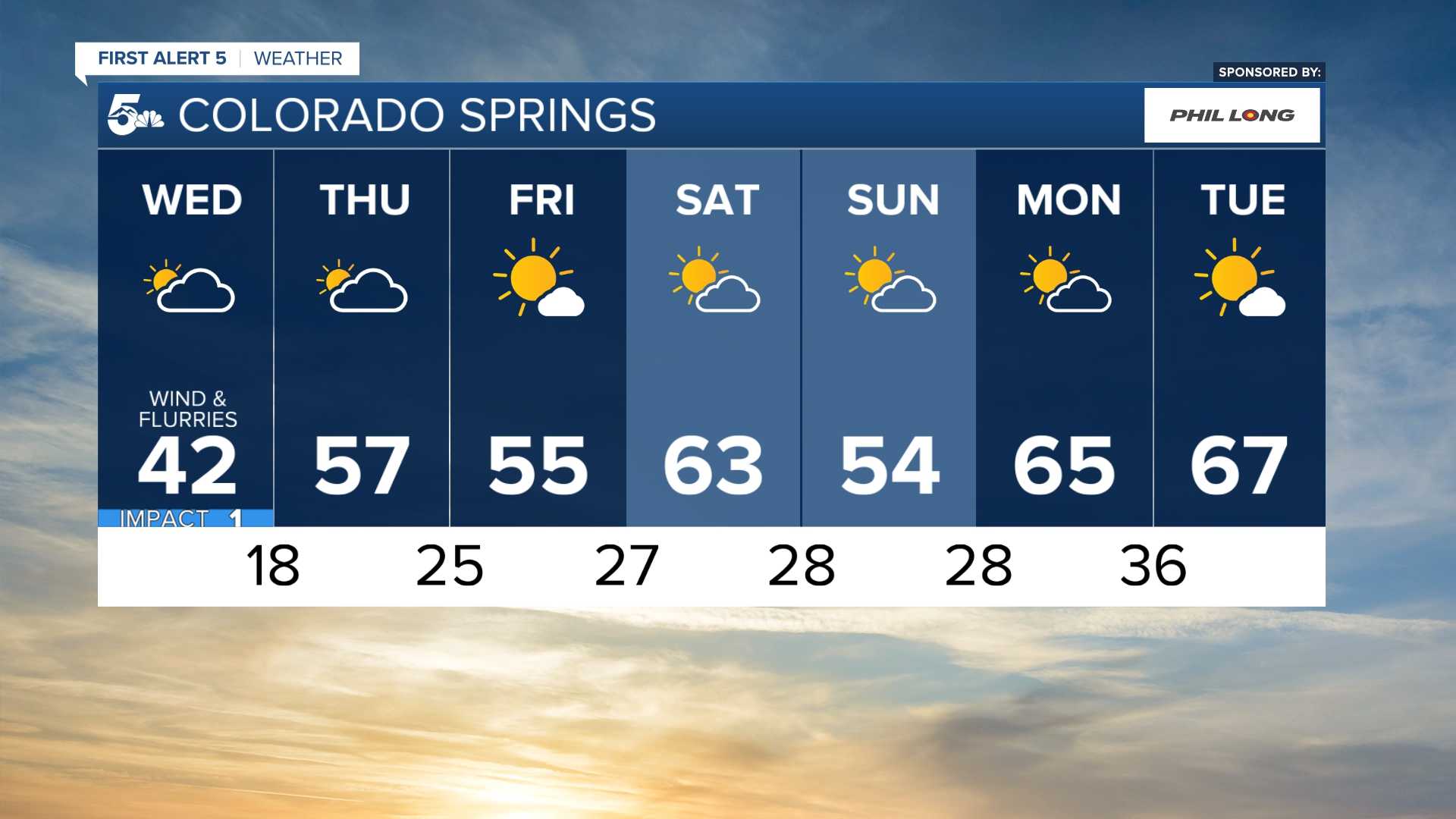
COLORADO SPRINGS, Colo. — Residents of Colorado Springs are bracing for severe weather this week, with strong winds and red flag warnings scheduled to take effect Monday morning. According to the National Weather Service and local meteorologists, gusts of 30-50 mph are expected, raising concerns over fire risks.
A cold front making its way across the West Coast will contribute to a windy day starting Monday afternoon, as KOAA Meteorologist Alan Rose explained, “30-50 mph wind gusts, combined with single-digit relative humidity and dry fuels, have prompted red flag warnings starting at 11 a.m.” These warnings will persist until midnight, although they could be lifted earlier, around 8 p.m.
“Temperatures today will be well above average, topping out in the lower to middle 70s in Colorado Springs,” Rose added, emphasizing the unusual warmth for the season.
Forecasts indicate a dramatic change coming on Tuesday, with temperatures expected to plummet by 10-15 degrees, dropping highs into the 50s. Rose cautioned, “A strong southwest wind in advance of our next cold front will keep fire danger threats very high, with a Red Flag Warning in effect from 11 a.m. until 8 p.m., and gusts in Colorado Springs expected to reach up to 45 mph.”
The transition from warm weather to cold will bring a chance of snow by Tuesday evening, particularly in the Tri-Lakes area and northern parts of Colorado Springs. Rose forecasted, “1-3 inches of snow will be possible in the Tri-Lakes area, with 1-2 inches likely in northern and western Colorado Springs, although the south side may not see any accumulation.”
The conditions will shift again on Wednesday, with drying weather expected, but temperatures lingering in the lower 40s. By the end of the week, high winds and fire threats may resurface, with a chance of snow showers returning by Friday morning, as Rose mentioned, “Right now, impacts from snow late this week look small.”
Beyond Tuesday’s gusty weather, the four-day forecast for the region is as follows: Tuesday will feature a chance of rain and snow showers, high near 60, and winds gusting as high as 35 mph. Wednesday’s high is expected to be around 44, while Thursday may see a high near 58. By Friday, anticipate mostly sunny conditions with highs near 51 and gusts up to 30 mph.
In light of the severe winds and ongoing fire risks, officials urge residents to stay informed and prepared. Both red flag warnings and high wind warnings are in effect throughout Colorado, with particular alertness needed in areas flagged for high winds and low humidity.


