News
Severe Winter Weather Hits Midwest, Causes Travel Hazards and Incidents
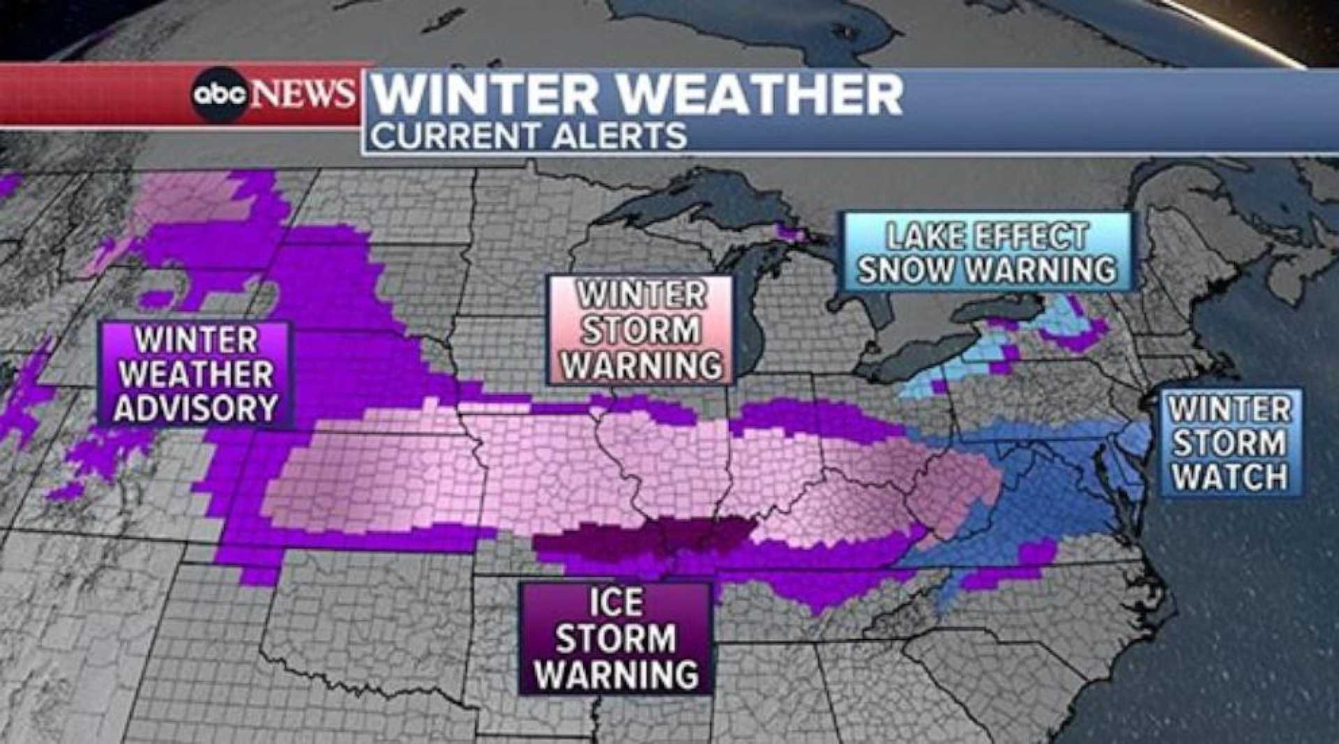
MADISON, Wis. (WMTV) – Today marks a First Alert Weather Day across the Midwest as moderate to heavy snowfall is expected throughout the day, creating hazardous travel conditions. A Winter Weather Advisory is in effect from 9 AM today until 3 AM Thursday.
The impending snow is attributed to a low-pressure system moving south of the region, which will begin to spread moisture into southern Wisconsin around daybreak. This weather pattern will lead to snowfall accumulation across various parts of the state.
Forecasts indicate that most areas in southern Wisconsin could receive between 3 to 6 inches of snow, with higher totals between 7 to 9 inches expected closer to Lake Michigan. Snowfall is anticipated to taper off after midnight, with clearer skies emerging at daybreak Thursday and below-average temperatures extending into the weekend.
In addition to today’s snow, another winter storm is projected to impact the region later this week. Snow is expected to begin on Friday afternoon, continuing through Friday night and into Saturday, adding several more inches to the already significant snowfall total.
“Travel today will be hazardous, especially in the afternoon when snow is at its peak,” said meteorologist Jake Thompson. “If you’re on the road, expect delays and use caution.”
HUNTINGTON, W.Va. (WSAZ) – Residents in southern counties should brace for steady wet snow as it moves northward. Weather experts report snow accumulation rates of approximately 1 inch per hour. This morning, temperatures are hovering near freezing but are expected to rise through the day.
Local forecasts suggest that the rain/snow line will reach Charleston by afternoon, leading to a mixed precipitation scenario. Areas may see anywhere from 2 to 4 inches of wet snow throughout the day, with the potential for flooding concerns as warmer conditions lead to rain washing away remaining snow.
Across Omaha, Neb., residents are reporting leftover light snow as they transition into the morning. Light snow is expected to fill in by night, potentially creating tricky travel conditions for Wednesday morning commuters.
Meanwhile, in Parkersburg, W.Va., the Mid-Ohio Valley is under winter storm warnings until 11 AM Wednesday. Roads are forecasted to become slushy as temperatures remain close to freezing. Alerts have advised the public to leave adequate space while driving to avoid accidents.
In Madison, emergency officials have reported two major accidents, with one being fatal, attributed to the snowy conditions. This incident underscores the dangers of winter travel.
As road crews work to clear snow, feedback from the public highlights a mixed response, with many praising their efforts while also reminding others to drive cautiously as slick, icy conditions remain.
“We always learn lessons after each snowfall and aim for continuous improvement in our response,” commented Brad Metcalfe, Nelson County Emergency Management Director. “Preparation is key, and our teams took proactive measures ahead of this storm.”
Community members are advised to stay up-to-date with local forecasts and conditions, using reliable news sources. Winter weather preparedness, including checking road conditions and potential school closures, is essential for safety during this stormy period.


